Showing posts with label Lost Lake Trail. Show all posts

Wednesday, September 16, 2015

Tom's Visit

It took my former riding buddy and college teammate Tom 7 years to make it up to AK for a bike ride.
WANNA RIDE BIKES!?
OK, in fairness, Tom has been living and working in some of the country’s most scenic and spectacular National Parks though out those years.
Still, Tom and I went 6 whole years between our last ride on the east coast at Kingdom Trails a day or two before I left for the north, and our eventual re-union in SoCal last fall.
A few months later, Tom gave me a pretty awesome tour of Yellowstone National Park when I was visiting the area last January, and when I finally got him to commit to a visit to AK, I knew I had to pull out the stops for his visit.
Initially, I had thought a road trip to Whitehorse, followed by a short trip to the Kenai for some fishing, was in order. The road trip would provide a great view of the giant state, and I’ve yet to hear someone say something disparaging about the Yukon riding.
We did have some time limitations though, and despite this being an epic summer rarely wetted by rains, Tom of course picked the one week rain seemed sure to fall.
Multiple sources said the Whitehorse trails rode well in the rain, and I don’t doubt that, but driving 24 hours roundtrip to ride and camp in the rain just didn’t add up, especially considering how dry the trails where here.
I decided we would roll the dice and stay local, ride in the rain if we had to (we did), but at least have access to hot showers, an indoor hangout, and local knowledge of the weather patterns and trails (hey, we also did).
Aside from all this, I can’t help but feel boastful of the ScAk trails, and wanted Tom to see them, not some system a full day’s drive off.
Without question, that was the right call.
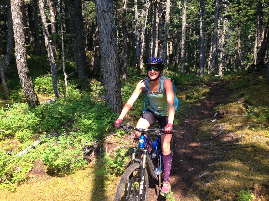
The first two days of Tom’s trip were gray and wet. We rode Hillside in the rain, and splashed through puddles in Kincaid during a couple hour lull in the precip the following day. The nice thing, is that as noted, the trails were so dry this year, they never got muddy, and dried instantly.
By day three, what had been a gloomy forecast began to change: the sun was coming out, and conditions were looking to be spectacular.
I wanted to take Tom up to the Valley and ride Keppler-Bradley and GPRA, but the storm system was lingering in the north, while gorgeous blue skies broke over Anchorage.
For the first time in days, Tom saw the Front Range, along with the snow-capped Tordrillos across the Inlet.
As it turned out, Anchorage was not secretly located near Fargo, as Tom had been beginning to suspect.
We rode Kincaid again, joined by Joe. As I expected, Tom loved the trails there, and didn't mind hitting them twice.


The next day Tom and I loaded up the Suby and headed south to base camp at Braun’s cabin and ride the Kenai.
The Chugach National Forest had just finished brushing out the Russian Lakes Trail the previous week, bringing this normally spring and fall only trail into the fold waaaaay early. I explained to Tom beforehand that this was a real bonus to have this ride on the table in mid-August, but I’m pretty sure he would have figured that out on his own as I freaked out about a dozen times on-trail.
We rode the Russian Loop, and as hoped, the well-drained trail was mud- and veg-free. When we passed where the trails runs along the river bank around mile 8, we could see hundreds of bright red sockeye swimming in the current below.
 
Heading over the outlet of Kenai Lake. Photo T.A.

Stopped for a snack on a beach on Kenai Lake.


Photo T.A.

Hanging out on the shore of Upper Russian Lake

Photo: T.A.

Upper Russian Lake Cabin


Blooming Fireweed in the avalanche meadows on the way out
  
The next day we headed toward Seward to do the Lost Lake Loop. Again, we had perfect blue bird skies and a gentle south wind to keep it cool.
As we finished up the 7-mile Primrose section of the Iditarod Trail, I asked Tom if he wanted to take the straightforward and easy route down the highway to re-connect with Lost Lake Trail, or go ride the Bear Lake section of Iditarod – explaining that the latter was hilly, loamy, not always flowy, and that a 2,000 foot climb still lay ahead.
Tom gave me a confused look.
I tried again: “Easy or hard?”
“Hard,” Tom said.
I was stoked. I know a lot of people pass up on this section, but that’s really their loss.
We stopped once on our way to Bear Lake to gobble up the abundant and fat blueberries that lined the trail, before making the surfy descent into Seward. The shore-side segment of the trail is super technical, and I knew Tom was probably going to want to session some of the features.
He agreed that this stretch is probably the closest thing in Alaska we have to the type of riding he and I did in college, at least, as far as the density of technical features.
As we neared the south end of the lake, we passed over the small inlet stream, and hung around a while to watch up and close as salmon battled each other for mates.
A little while later we were riding high into the alpine of the Lost Lake plateau.
Big shocker, but this did not disappoint. I think my favorite moment was when we reached the top of the plateau just before the lake comes into view. Tom took a ton of photos to the south toward Resurrection Bay.
I let him make a couple comments about how spectacular the view was, and how it couldn’t possibly get better, then we rolled 100 yards across the flat plateau until the lake and the bay were both in full view. I had to ask if he was sure about they view.
Post-ride fried halibut to-go, enjoyed down by the water was in order after descending Primrose.
 
Tom and I have very different pre- and post-ride routines. For example, pre-ride, Tom likes to wheelie, bunny hop, and skid around the parking lot, while I like to chill, stretch, and prep. Post-ride, Tom likes to fall off his bike and hope the gods deliver him a giant pizza, while I like to wheelie, bunny hop, and skid around the parking lot...OK, well, maybe I did some of the latter just to get back at him. I was really glad to take this shot before setting off on LLL though.

Lots of blueberries

Lots.

Tom took a few attempts, but finally rode the bridge...no salmon were harmed.


Photo: T.A.

Favorite shot of the trip. Photo: T.A.
 
Friday dawned with high gray clouds, but the forecast only hinted at a slight chance of rain.
I had really hoped to do a Devils-Cooper shuttle, but could not arrange a shuttle, and doing the loop wasn’t too high on the list after five days of consecutive riding. The backup plan was to ride up Devils and through Res to the Hope overlook, maybe descend to East Creek if we had the legs, and then turn around.
The weather had other plans. Hypothermia rain started to fall right as we got to Devils Pass, and knowing the Hope overlook view would be pretty unspectacular, we decided to go hang out in the shelter of the Devils Pass Cabin for a while.
As it was, the rain really wasn’t falling too hard, and it didn’t take us long to descend out of the wind.
After 3 days of AK blue bird, Tom said he appreciated seeing a slight dose of reality in terms of what the weather could dish out.
The trail was great even wet though, Devils is already well drained to begin with, and given the dryness this year, didn’t even form any puddles.
 
No pics from a rainy day but Tom made this cool slow-mo video.
 
We headed to fish camp that evening to spend Saturday working the UR fishing event. The tournament went smoother than it ever has, and I appreciated Tom’s willingness to chip in and drive a shuttle. Tom got real familiar with my old commute to work (I mean, he’s fairly qualified at driving vans after all), all in return for a little fresh halibut and salmon. Good deal huh?
That evening, just before I was about to call it a night, walking through the dark between one of the out buildings and the lodge, I looked up to see the northern lights blazing across the sky. I ran in and got Tom up, and we hung out on the dock for an hour while they put on a hell of a show.
 
Double rainbows over camp. Photo: T.A.

No good shots of the northern lights, but Tom snapped this cool one of the boats waiting for their clients Saturday morning. Photo: T.A.
 
What a way to end a great trip.

Tuesday, September 1, 2015

New Wilderness, Meet the Old Wilderness; Part 2

Part 1 (LINK)
July Fourth weekend, it’s Anchorage’s favorite weekend to load up all their toys into a vehicle coupled to a trailer, neither of which may pass a basic mechanical inspection, and hard-charge it down the Seward Highway, making 8-car passes on inside corners, until eventually, someone blows it and shuts down traffic.
Don't break your bike, and don't break your riding buddies!
Is it any wonder why I always hope for rain or an excuse to stay in town this weekend?
Solitude is a hard-to-come-by commodity anywhere on the Peninsula this weekend, but that’s not always the point.
My wishes for rain or clouds denied: brilliant blue skies dominate, and I can’t resist either, so I take off on the Lost Lake Loop.
Damnit. Why can't it rain (kidding).
 
It is assured, the name-sake trail in this 34-mile ride will be an absolute zoo.
As I climb from Seward, a hiker tells me: “We need to limit the number of bikers on this trail.”
“I could say the same thing about hikers,” registers in my mind, but oxygen debt and a limited ability to maintain the moral high-ground inhibits a response…mostly oxygen debt though.
I wonder why it is that she tells ME this, I’m slowly climbing by.
I can’t help but empathize with her a bit though.
I’m legitimately nervous that I will get nailed by a descending rider on some rent-wreck junker of a bike
 
(Edit: this almost happens a few weeks later when a rider comes careening down the canyon section just below tree line on a mid-90s vintage hardtail replete with rim brakes and an 80mm elastomer fork. Unable to stop before hitting me, I duck into the adjacent hillside, and the rider ended performing a complete cartwheel off the cliff side. He was lucky the vegetation that arrested his fall didn’t impale or twist him up too bad. No helmet on the joker either).
I feel like I’m making more noise than some of the descending riders, and that whole “uphill has right of way” rule seems lost in the blooming cow parsnip.
The funny thing is, I’m more nervous on this climb than I was an hour or two ago when I started to head down the mossy section of the Iditarod Trail that leads from the Seward Highway in Divide to Bear Lake.
 
I passed a surprisingly large group of hikers very near the start of the section – surprising because I hardly ever see people on this trail – and they warn: “There’s bears at the lake!”
I ask “what lake?”
I get confused stares in response.
This is really helpful, as there aren’t many lakes in this segment of trail, nor bears for that matter: I mean, there is Troop Lake about a mile or so in – which is presumably where these people are headed, but I will skirt; and there is of course, the very “beary” Bear Lake, 7 miles down the trail in Seward, where I’m headed; and then there are maybe 3-4 other bodies of water I’d probably describe as ponds between these two bodies of liquid, but maybe they’re lakes with bears too?
The thing is, I sometimes joke, this section of trail was actually cut by the Feds for the bears. As noted, I almost never see people on it. Fat and plump blueberries grow abundantly here, and blue/purble bear scat litters the trail from mid-July through August. Closer to Seward, Bear Lake, which I don’t think got its name because of its oblique shape, is the end run for thousands of returning Bear Creek salmon with nowhere to go and nothing to do but die and present their protein-rich bodies to those who might wish to feast upon them.
Bear Lake salmon.
 
All the while, the dense, old-growth forest makes this a lovely corridor to pass between Resurrection Bay and the Snow River drainage, if you’re into hanging out in deep, dark, quiet forests – kinda like bears are into.
So yes, this is really helpful beta: there could be some bears, by the lake.
I’ve been thinking lately, we actually need a sign at the narrow isthmus between mainland AK and the Kenai Peninsula that says: “Caution: Bears ahead at lake.”
What? It wouldn’t be wrong.
Neither were the hikers though.
What lake?!
 
Guess what I find at Bear Lake? Yup. Momma and her 3 millennial cubs out for a stroll.
These cubs are all just about as big as momma, and after the instant fear has washed away, I think, in retrospect, those cubs need to move out already.
Maybe they’re still perfecting their artisanal fish carcass sculpting?
It could have been a bad situation though. The section of trail along the steep east shore of Bear Lake is tough: technical, lots of blind corners, dark, and ledgy.
I even had the thought, moments before I interrupted this bear family’s outing: “What if I dropped into one of these blind descents, or came around one of these ledgy corners, and came face to face with a browny?”
If I had any time to react at all, my only exit option would be to leap away from the steep hillside into the thickets of devils club and alder below, hoping the bear deferred to better judgment and didn’t follow suit.
I’m lucky I spot them down one of the few stretches of trail with a good sight line, maybe 50 feet. Even still, mom huffs, and she hesitates before turning tail. The three cubs struggle to turn around on the narrow trail to flee, clumsily bumping into eachother.
Had it been a closer encounter, they might have realized they had good odds for a beat down.
Admittedly, I was shocked.
Smiles on the Iditarod trail.
 
I’m used to seeing a lot of bear sign on this trail, especially later in the summer when the blueberries are ripe and the shores of Bear Lake wreak with the stench of rotten salmon.
The blueberries were still white though, and the fish had yet to make a strong showing at the lake, or, at least start dying by the hundreds.
More, it was 1 in the afternoon on a bright sunny day.
Not really when I expect to find a family of bears out and about.
If you slit a tubeless tire and happen to have a tire boot, don't waste your time with the sticky adhesive, it won't work with all the sealant in the tire...I got a lot of practice this summer.
 
I guess that’s just it though: In the new wilderness, and the old wilderness, it’s never clear what the dangers will be, it’s just how different the dangers actually are in each, even if the two can exist in the exact same place.

Wednesday, June 3, 2015

Can I Mountain Bike the Kenai This Weekend?

Figuring out how the trails on the Kenai are going to ride, and whether they’ll be too snow-covered, rain-soaked, or overgrown with vegetation, might not be rocket science, but it's certainly not as obvious are riding in Southern California either.

Every year is different. Heavy winter snows, cold or hot springs, summer rains, the onset of the fall monsoon season, and early or late killing frosts can influence how quickly different trails come into or fall out of favor by as much as two weeks.

In general, I tend to target trails, or segments of longer trails, as listed below. In some cases, I may target certain trails (e.g., Russian Lakes, Johnson Pass) more heavily in the earlier part of the season, even if other trails like Resurrection or Lost Lake are snow-free, as the former will be unpleasant to ride once they become overgrown, while the latter will be ride-able through the height of summer and into autumn.

Mid-May through end of June:
Gull Rock Trail
Russian Lakes Trail
Johnson Pass (south end tends to come in 1-2 weeks prior to north end)
Devils Pass Trail
Cooper Landing to Swan Lake+ on Resurrection Pass Trail
Iditarod Historic Trail from Primrose Campground to Mile 17 of the Seward Highway

July through end of August
Resurrection Pass Trail
Devils Pass Trail
Iditarod Historic Trail from Bear Lake to Kenai Lake
Primrose Trail
Lost Lake Trail
Crescent Lake Trail

September through end of October
Devils Pass Trail
Swan Lake to East Creek on Resurrection Pass Trail (accessed by Devils Pass Trail)
Crescent Lake Trail
Iditarod Historic Trail from Bear Lake to Kenai Lake
Primrose Trail
Lost Lake Trail
Russian Lakes Trail (after a few good killing frosts)
South half of Johnson Pass Trail (after a few good killing frosts)

The Kenai at its best!
Within season, another tricky issue can be figuring out how muddy a trail will be due to recent rain, and whether they will be worth the drive. There are three well-placed RAWS weather stations that capture reliable accumulated precipitation data on the Kenai Peninsula that I make regular use of. A good rule is that for every 1/2-inch of accumulated rainfall, as many days should be allowed for the trails to dry out. Obviously, this is just a general rule, and needs to be evaluated in relation to how well the target trail drains, the time of year, and the weather before and after the rain.

Some trails on the Kenai are better armored and drained than others (listed below). Additionally, at the height of the growing season, plant uptake can help absorb a lot of ground moisture. Later in the season, as the plants stop growing and the days and nights get cooler, water tends to stand around for far longer. The best post-rainfall weather is of course, hot, sunny, and breezy.

 
RAWS Weather Stations
Granite Creek (South Turnagain Pass) (LINK) Best for north half of Johnson Pass
Kenai Lake (Moose Pass) (LINK) Best for south half of Johnson Pass; helpful for Crescent Lake and Primrose
Broadview (Cooper Landing) (LINK) Best for Resurrection Pass Trail, Russian Lakes Trail; helpful for Crescent Lake Trail
 

Pro tip: While other weather stations located on the Kenai that are run by the AK Department of Transportation, SNOTEL, and HADS don’t record accumulated precipitation, they do show daily rainfall amounts, along with temperatures and wind speeds. These stations are located in a much broader swath of locations, and can provide helpful clues as to what might be happening away from the RAWS sites. As we all know, the weather in AK can be very variable, and what is happening in one place, could be completely different just a mile or two away.


The other end of this guessing game is trying to figure out what the future holds, or more precisely, if rain is in the forecast, whether you will get wet. Realistically, this is much more involved. As a general rule, rains tend to be more persistent and heavier closer to Seward, and more showery further inland - but that's totally dependent on the storm track and severity of the weather system. If you're not a weather dork, the next best bet is to keep an eye on the weather a few days in advance, and use reliable forecast tools from the National Weather Service, not some Google app on your smart phone.

Wet Weather Best Bets (Season-Dependent)
Russian Lakes Trail
Devils Pass Trail
Lost Lake Trail
Primrose Trail
South end of Johnson Pass Trail
Iditarod Historic Trail from Primrose Campground to Mile 17 of the Seward Highway


Wet Weather Trails to Avoid
Resurrection Pass Trail
North end of Johnson Pass Trail