Showing posts with label Johnson Pass Trail. Show all posts

Tuesday, June 27, 2017

Two Favorite Kenai Epics

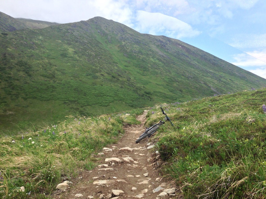
Russian-Res-Devils Loop
Distance: 76 miles
Climbing: 7,000 feet
Season: June, or late September
The gist:
Start at Devils Creek Trail Head, take the Seward Highway 2 miles to Tern Lake Picnic Area, and head down the Old Seward Highway to where it meets up with Crescent Creek Road/Quartz Creek Road. For a 90 miler and an additional 1500’ or so of climbing, add an out-and-back on Crescent Lake Trail. Otherwise, follow Crescent Creek Road to Quartz Creek Road to the Sterling Highway. Cross the highway, heading left toward Cooper, and take the first jeep road immediately on the right. The jeep road climbs steeply. Stay left past the junction with a cell tower. After passing a high point with a great overlook, the road spits you back down on the highway briefly. Ride the shoulder carefully for about 100 feet until you spot the ATV trail heading into the woods on the right. The ATV trail is actually rather techy in places, even though it parallels the roadway. It will briefly spit you back out on the shoulder twice on the way to Cooper: first very briefly onto a gravel shoulder before heading back into the woods; and again to cross a driveway (take the driveway for 20 feet and the ATV trail will dive left off the driveway), before eventually joining a utility corridor. The corridor can get a little mucky, and trail will exit to the left to follow a wide and safe gravel shoulder the rest of the way to Cooper.
This ATV segment sounds more complicated than it actually is, and is a million times safer to ride than riding the shoulder of the highway! The short section of highway between Cooper Landing and Quartz Creek Road is not safe to ride!
Head through Cooper, cross the Kenai River (pedestrian bridge is located on downstream side of bridge), and cross the highway onto Snug Harbor Road. Take Snug up to Russian Lakes trailhead. After riding the 20-some miles of Russian Lakes trail, it may be worth taking a quick side trip toward the campground to refill on water. This is close to the mid-point of the ride. When you hit the trail head/parking lot, go left, up the campground road toward the campgrounds. Water is available at the RV dump station on your left, maybe ¾ of a mile.
From Russian, head down to the Sterling Highway, go left on the highway to the Resurrection Pass Trail Head.
Take Res Pass Trail to Devils Junction, and drop down Devils Creek Trail back to the TH and your car.

Hints:
This is a really smooth link up, with a lot of gravel to tie the trails together, with very limited pavement. The trails themselves are pretty easy: Russian is about as advanced as things get, but it’s a “descent” on this route. As noted, the ATV connection between Quartz Creek Road and Cooper Landing sounds complicated, but it’s literally an ATV trail next to the road, just keep following it. Also as noted, it has a few short techy sections to keep it interesting, and is a major asset to have as an alternative a connection to avoid a very dangerous segment of roadway.
Water is available at the Tern Lake Picnic Area (two people to use this pump), Quartz Creek Boat Launch (spigot), and the Russian River Campground (spigot).
The season on this ride is pretty much June onward, and is limited by snow in Res and Devils Pass early in the month, and vegetation on Russian later in the month. It’s pretty likely that this ride will include some snow drift cyclocross action through Devils Pass.
This loop could open up in September-Early October in cold and dry autumns.

I hit this loop for the first time on 2016 with Carey G, and again this year with Chuck D. Both years, the early to mid-June timeframe seemed to be the money spot for low veg and few snow crossings.
Both years, I opted for the simpler 76-mile option, and both years, the total ride time was around 7:45 at a reasonable pace, though could easily be driven down by quite a bit with more motivation.

In a head-to-head between this loop or the Resurrection-Devils-Johnson Loop (90 miles), I pick this one as my favorite.

Res-Devils-Johnson 2017
90 miles
8,000 Feet climbing
Time: Mid-June through July 4

I’d completed RDJ in various formats and rig choices in 2013, 14, and 15, but I just wasn’t super pleased with this route, and I took a break from the RDJ last season. The forecasts and fast-growing veg on Johnson last year didn’t inspire me to get after it.
This year, I had a choice for the weekend of June 24-25: do Arctic MTB’s Double-Down Race on a course designed by Ryan G, and well suited for someone who does well on climb-heavy and rooty courses (ya, that’s me), or head to the Kenai. It was a tough call, but the forecast was spectacular, and with July Fourth the following weekend – a holiday I try not to spend on the Peninsula – and a summer so far lacking in sunny weekends, it seemed like a Kenai Epic was a worthy pursuit.
Meredith was interested in riding the trail portion of the RDJ this year, and after mulling some different options, we came up with a new twist.
For starters, we’d ride the route clockwise, which is the opposite direction of how I’ve always ridden it. We’d also start the ride at the North Johnson Pass Trail Head, and this time, I’d employ a road bike for the long road segment.
The key element to this plan was just that: we’d be leaving my road bike at a colleague of Meredith, Doug’s, cabin, outside Hope. 
The bane of this loop is it’s 28 miles of road (24 paved) between North JP TH, and the North Resurrection Pass Trail Head. This long stretch of pavement has long steered the counter-clockwise routing of the ride, as at least that put the bulk of the hateful road riding pointed toward sea level.
I tried to ease the pain of this long road connection in previous renditions by riding a hard tail for the whole loop, or having a hard tail staged at the North JP TH for just the road portion.
I wasn’t sure that riding a road bike after 67 miles would really make me think better of this loop, but it was obvious almost immediately: the 24-miles between Doug’s and the car went way smoother and faster with drop bars and 28c tires. Lest I say it, I really enjoyed the road connection!
The other two benefits however, were less apparent beforehand, but definitely afterward. First, riding Johnson Pass north to south right off the bat gets the most technical part of the ride out of the way immediately, and second, climbing Devils and up to Res is downright pleasant compared to the opposite. Climbing the north side of Res is the most tedious, dull, and hateful section of trail on the Kenai…not that I have strong opinions on it or anything...
Early on in the day, we bumped into Kenai 250 riders Aaron, Dusty, Anson, and Kevin. I had a feeling we might see a few of the boys later on.
The clouds lifted as rode through swarms of hatching bugs on Johnson, but temps stayed reasonable. In the south Johnson TH I popped my helmet off my head, and a mass of dead midges fell from my head!
We stopped at the “rust pipe” at Tern Lake Day Use Area on the 7-mile road connection between south JP and Devils for a water refill. Up Devils we caught back up with Kevin, and could see Anson a little ways off as we neared the high point.
For time management (Meredith’s ride would end around 67 miles at Doug’s cabin, while mine would continue another 24 miles to the car) we decided this would be a good time to split off.
I bombed through the descent to Hope, and onward to the cabin. Having learned from before, I left the clock running through my turnaround for feed-management purposes. I dumped my pack, changed to road shoes, snapped in some dark lenses, and made sure to grab my car key.
I felt really good, and as I steered the road bike out onto the Hope Highway, my legs told me to give it all I had.
I had an absolute blast powering up Hope Highway and onward on the bike path to Johnson.
About a mile or two before I made it to the car, my legs started to fizzle, so I tapped a little deeper, casting aside the thought of a cool down, and spinning the Solace’s slick tires over loose stones right up the short gravel road to the car.
I rolled in an awesome and complete physical and mental wreck.
Great ride.


Ready for a Kenai July epic?
Here’s my favorite:

Tuesday, June 30, 2015

RDJ 2015

Another year, another RDJ (2014) (2013), another twist.
Last year, I literally couldn’t wait to knock out this loop.
This year, I was ambivalent at best. I had a new plan for a big, late-spring loop, CRReD: Start at Devils Pass TH, head down the road to Tern Lake and take Old Sterling Highway to Crescent Lake, out-and-back to Crescent Lake, onward to Snug Harbor Road, up the 14 miles or so of gravel on Snug, “down” Russian Lakes Trail, across the street to Resurrection Pass Trail, and hang a right one-and-a-half dozen miles later on Devils Pass Trail to close it all out.
I think the CRReD loop would have totaled up to about the same mileage as RDJ (~90), but where the latter sports something like 30 miles of pavement (albeit, mostly on a scenic bike path and the even more scenic Hope Road), CRReD would have something like 4 miles of pave in total, and would make all the rest of its connections on jeep roads, atv paths, and gravel roads.
Then the Kenai caught on fire. The south half of Resurrection Pass Trail was closed due to a 250-acre fire above Juneau Lake, and combined with the smoke of the Stetson Creek and Card Street fires, filled the Cooper Landing area with haze and smog.

Card Street Fire in Sterling. Photo: KTUU
CRReD was a no-go.
Johnson Pass, in awesome condition, beckoned, but there was this nagging feeling that I know I felt, and I think Adam did too, that with perfect weather and perfect trails, if the RDJ didn’t happen, not doing the RDJ might be a regrettable decision later on.
Out of curiosity, I rode the north half of Res on Friday to the Devils Pass junction, and found that smoke from the fires was a non-issue. I could hardly even make out where the distant fire was.


No smoke on the north side of Res or Devils Junction.
We went ahead and met at the south Johnson Pass trail head on the earlier side the next day, thinking we’d do it over-and-back.
With wheels on, and maybe a few minutes from roll-out, Adam looked at me and suggested a new twist.
We could park my car at the north Johnson Pass TH, and start the ride at the north Res TH.
The thinking was two-fold:

  1. Carly was planning to meet us at Bertha Creek Campground near the north Johnson TH, and Adam wanted to get to spend some time with them in the evening before Gus hit the sack for the night. Doing the 8-9 hour RDJ would mean Adam wouldn’t get much time with Gus, but if he split off at the north Johnson TH, he’d have ample time and still get a 60-mile ride in.
  2. By starting at north Res and ending at north Johnson, we could eliminate what is the obvious bane of this long loop, the 27 miles of road riding between the two trailheads, while enjoying a very reasonable 62 miles of trail (OK, there’s 7 miles of road riding between Devils Pass TH and south Johnson). Bottom line, we’d still get a solid ride in. If I was so inclined, I could carry on solo and retrieve Adam’s car from the start at north Res TH, and if not, Adam didn’t mind going to get it the next day.

Base camp
The car staging would eat up over an hour, but it was such an obvious win, we immediately mobilized.
The day turned out to be pretty well perfect. Low-slung clouds in the morning helped to stave off the heat for a little while. Eventually lifted and revealed brilliant blue sky. Trail conditions were superb; we got a wiff of smoke near the top of Res; and the veg on the south half of Johnson was a little unruly, but that might have been my only complaint.
We also saw a ton of familiar faces.

LV Ray Peak from Trail Lake.
We hit the north Johnson TH in 6 hours. I think just a bit before we topped out on Johnson, I’d mentally committed to closing out the loop on my own, but I kept my mouth shut as it was kind of nice to have the option.
I actually felt really good when we got to my car though.
Adam retrieved some clothes out of the trunk, and I switched to my hard tail. If I’d known what the game plan was from the outset, I might have had the bike a little better prepped (lubed and tires at full pressure for road riding). With the option to use a lighter and more efficient bike, staged perfectly at the start of the long pavement section, not switching seemed dumb.
I stopped my clock for the 15 minutes we were in the lot. I don’t know how I feel about that in the scheme of things.
Basically, the next 2.5 hours turned out to be really brutal, and completely sucked, but, in the best way.
A few miles down the bike path, my hopeful tail wind turned to a steady head wind, and although it wasn’t too strong, it was persistent the rest of the way to Hope.
The bigger problem, was that I bonked, really hard. I have no idea why I didn’t have a bite to eat while I was switching bikes. I have no idea why I decided that since my clock had stopped, so had my metabolism. Regardless, I got nailed hard, and that deep into the ride, the margins were too thin.
I reached for a pack of shotblocks in a jersey pocket, but realized they weren’t going to act fast enough, nor be sufficient to get me out. A couple miles later I dug out the emergency Gu that lives in my pack.
As always, the e-Gu saves. My head stopped floating on the end of the balloon cord it was on.
While the road riding sucked, it was obvious my body had been good for the 60 miles/6 hours, and the additional 30/2 was what was going to make this ride count. As much as I hurt, and as brutally as my legs screamed the final miles on Palmer Creek Road, I was really glad I was closing it out.
That was kind of it. It was really uneventful. This was the latest start for this ride, and thus the latest finish, which was kind of nice as the evening air cooled a bit and traffic was very light.
I got to Adam’s car and shut the clock off at 8:30 total.
If I ran the clock through the transition, it would have been 8:45, which was last year’s time.
I guess that leaves some questions in my mind. If I’d stayed on my full suspension (i.e. 0 transition time), would my total time have been extended to 8:45 because of the bigger bike’s inefficiency?
Did I “cheat” by using a lighter bike for the paved section, and a big bike for the trail sections?
I’m not sure.
I think it probably would have been about the same. I did the whole loop on a hard tail last season, so I still got the advantage of having the light efficient bike on the pavement and the climbs on Res and Johnson.
I also don’t find my current full-sus bike to be terribly inefficient on the road.
In the future, I’d probably continue to complete this loop by starting and ending at Devils Pass TH (I just like ending really long rides by coming down Devils), but I’d also do this variation again, particularly if we had a similar situation.

Wednesday, June 3, 2015

Can I Mountain Bike the Kenai This Weekend?

Figuring out how the trails on the Kenai are going to ride, and whether they’ll be too snow-covered, rain-soaked, or overgrown with vegetation, might not be rocket science, but it's certainly not as obvious are riding in Southern California either.

Every year is different. Heavy winter snows, cold or hot springs, summer rains, the onset of the fall monsoon season, and early or late killing frosts can influence how quickly different trails come into or fall out of favor by as much as two weeks.

In general, I tend to target trails, or segments of longer trails, as listed below. In some cases, I may target certain trails (e.g., Russian Lakes, Johnson Pass) more heavily in the earlier part of the season, even if other trails like Resurrection or Lost Lake are snow-free, as the former will be unpleasant to ride once they become overgrown, while the latter will be ride-able through the height of summer and into autumn.

Mid-May through end of June:
Gull Rock Trail
Russian Lakes Trail
Johnson Pass (south end tends to come in 1-2 weeks prior to north end)
Devils Pass Trail
Cooper Landing to Swan Lake+ on Resurrection Pass Trail
Iditarod Historic Trail from Primrose Campground to Mile 17 of the Seward Highway

July through end of August
Resurrection Pass Trail
Devils Pass Trail
Iditarod Historic Trail from Bear Lake to Kenai Lake
Primrose Trail
Lost Lake Trail
Crescent Lake Trail

September through end of October
Devils Pass Trail
Swan Lake to East Creek on Resurrection Pass Trail (accessed by Devils Pass Trail)
Crescent Lake Trail
Iditarod Historic Trail from Bear Lake to Kenai Lake
Primrose Trail
Lost Lake Trail
Russian Lakes Trail (after a few good killing frosts)
South half of Johnson Pass Trail (after a few good killing frosts)

The Kenai at its best!
Within season, another tricky issue can be figuring out how muddy a trail will be due to recent rain, and whether they will be worth the drive. There are three well-placed RAWS weather stations that capture reliable accumulated precipitation data on the Kenai Peninsula that I make regular use of. A good rule is that for every 1/2-inch of accumulated rainfall, as many days should be allowed for the trails to dry out. Obviously, this is just a general rule, and needs to be evaluated in relation to how well the target trail drains, the time of year, and the weather before and after the rain.

Some trails on the Kenai are better armored and drained than others (listed below). Additionally, at the height of the growing season, plant uptake can help absorb a lot of ground moisture. Later in the season, as the plants stop growing and the days and nights get cooler, water tends to stand around for far longer. The best post-rainfall weather is of course, hot, sunny, and breezy.

 
RAWS Weather Stations
Granite Creek (South Turnagain Pass) (LINK) Best for north half of Johnson Pass
Kenai Lake (Moose Pass) (LINK) Best for south half of Johnson Pass; helpful for Crescent Lake and Primrose
Broadview (Cooper Landing) (LINK) Best for Resurrection Pass Trail, Russian Lakes Trail; helpful for Crescent Lake Trail
 

Pro tip: While other weather stations located on the Kenai that are run by the AK Department of Transportation, SNOTEL, and HADS don’t record accumulated precipitation, they do show daily rainfall amounts, along with temperatures and wind speeds. These stations are located in a much broader swath of locations, and can provide helpful clues as to what might be happening away from the RAWS sites. As we all know, the weather in AK can be very variable, and what is happening in one place, could be completely different just a mile or two away.


The other end of this guessing game is trying to figure out what the future holds, or more precisely, if rain is in the forecast, whether you will get wet. Realistically, this is much more involved. As a general rule, rains tend to be more persistent and heavier closer to Seward, and more showery further inland - but that's totally dependent on the storm track and severity of the weather system. If you're not a weather dork, the next best bet is to keep an eye on the weather a few days in advance, and use reliable forecast tools from the National Weather Service, not some Google app on your smart phone.

Wet Weather Best Bets (Season-Dependent)
Russian Lakes Trail
Devils Pass Trail
Lost Lake Trail
Primrose Trail
South end of Johnson Pass Trail
Iditarod Historic Trail from Primrose Campground to Mile 17 of the Seward Highway


Wet Weather Trails to Avoid
Resurrection Pass Trail
North end of Johnson Pass Trail

Wednesday, July 9, 2014

Resurrecting the Devil's Johnson Redux, and Other Great Rides

All season I’ve been antsy to knock out the RDJ. The window in late May/early June never fully closed, but the rain blew in around the eaves when the 6th month of the year turned out to be the 5th wettest on record.

A few times I considered giving the loop a go despite this, fearful that the Johnson leg would eventually become overgrown. The beautiful weather two weekends ago for the Kenai 250 made me especially envious, but Adam kept talking me out of it: “It’s long ride, let’s wait for it to be awesome,” he would say.

Those are words from the wise; Independence Day found conditions on this 90-mile loop to be just that, awesome.

There were three differences between the RDJ2013 (LINK) and RDJ2014.

Minor: We parked our cars at the Devils Pass TH and started the day with the 7-mile road ride from Devils Pass TH to the southern Johnson Pass TH, getting this short section over with first.

Moderate: We rode hard tails instead of full-sus rigs.

Major: I was joined by Adam, as opposed to going it solo last year, and did not have to chug through 9 hours mostly on my own.

Without doubt, these were all improvements.

I was a little worried that I’d regret being on the stiffer bike, partly for some of the lumpy sections on Johnson and later on Devils, and partly because I have not spent more than 2 hours and change on the hard tail on any single ride. Neither proved to be an issue. While the lack of rear suspension entails a bit more conservative riding in places, overall, the Scale rocketed up the south side of Johnson with enough speed to shave 20-some-odd minutes off the usual pace for Johnson end-to-end. The ultimate reason for choosing the hard tail though, was the 30-mile road section between the northern Johnson Pass TH and the northern Res Pass TH. For this, the rigs were especially appreciated.

All in all, the ride sped by some 45 minutes faster elapsed, and 15 faster in the saddle.

It went even faster in my mind. We had bomber trail conditions the whole way. I was expecting more vegetation on Johnson, but actually it turned out to be no greener than it was a week ago, and mud was a non-issue. The bikes needed nothing more than a wipe down at the end of the day.

It’s funny how on long rides, you can cover so much ground, both geographically speaking, but also mentally, and yet, in the end, if can feel so singularly blended into one short experience. I can pick out a number of moments, defined in seconds: cleaning a steep pitch, rolling the wheels through a technical feature, shared moments of conversation, shared moments of silence, stretches where the bike had wings, stretches were the bike felt like a brick, passing other riders, passing hikers swarmed in bugs, and so on. One moment stands out more than any other though: the beginning of the 200-foot climb back up to the cars at Devils Pass TH from the Quartz Creek bridge. All I could feel was pure elation.

 
Ride stats, taken much later.
I thought the RDJ would take it out of me a lot more than it actually did. The legs were by no means lively on Saturday, but I had a really nice ride doing the Lost Lake Loop, sans the eastern section of Iditarod, with Sharon, Jolie, and Michael. The upper section of Lost Lake and Primrose was nearly dusty, and with some cool clouds and mist, I was relieved to be out of the heat.

Braun on a bridge.

Seward local. I can't wait until I'm old and grouchy. for now I'll just have to settle for halfway.

Clouds lifting on the plateau.

Jolie and Sharon are all smiles as the get ready to ride "some gnarly roots."
Sunday, despite a depressing weather forecast, the skies actually cracked blue in Cooper after a very short morning shower, and Jill and I set up a shuttle, and rode Cooper to Devils Pass TH. Jill wanted to get a closer look at this section as she will be riding this leg as part of a team in the Soggy Bottom in a month. The morning showers had failed to do anything to the trail, and we had perfect conditions.

Idyllic Kenai.

Swan Lake

Dangerous Alaska Critters


Is it next weekend yet?

In the meantime, mid-week road rides are pretty sweet. July means after work rides to Girdwood and back. Glass flat in the arm in the evening is hard to beat.
 

Wednesday, July 2, 2014

I Can't Get Enough Johnson...

Pass. Johnson Pass.
 
I can't get enough Johnson Pass.
 
When the glaciers receded off of the Northern Kenai Peninsula at the end of the last glacial epoch, they revealed a number of valleys that would, millennia later, offer irresistible routes through the rugged mountains.

Paths that were likely first colonized by wildlife, and later borrowed by the native inhabitants; eventually, Europeans arrived in search of mineral wealth and needed a way to transport their supplies and machines. These narrow winding paths were sometimes improved to handle their steed and wagons.

Johnson Pass, a 1400+ foot summit that divides the south flowing Johnson Creek, and the north-flowing Bench Creek, served as an all-season route between the seaport town of Seward and Hope mining district.

Why, in the century that followed the stampede, the engineers of the modern Seward highway dodged sharply away from the mouth of Bench Creek, I don’t know, but the route was relegated back to trail status.

I guess I can only be so thankful.

The Johnson Pass over-and-back has been a favorite this spring.

It always is, but this year, it was by far the favored child: 5 separate rides, 4 times over and back and one south side out and back; and though the herbaceous vegetation that buries this trail is soon to overtake it, I sense I will see it at least one more time.

It was hard to resist in 2014. Some years this trail never really comes in. In 2012, I never rode it end to end once. Deep snows of the 100-year winter followed by a massive spring shed cycle and ample melt water, left the northern section of the trail buried in a blanket of white and green.

This year though, it was perfection.

Brushing from end-to-end, ditching, and other drainage work, made this trail go from good, to all time.

There’s something about this trail that just satiates everything I love about riding here.

It’s long enough, but not too long.

It’s technical, one of the more technical trails of the Kenai, but it also has plenty of sections where the bikes can get wings.

It’s never boring, there’s always a challenge around the corner.

You might see a ton of people, or you might be alone; I never know what to expect.

I could go on, but I think I’ve made my point.

I sometimes wish the Forest Service would contract with a professional to take a quad through the trail in early July to push down the herbaceous veg, and extend its season, but than I wonder, if I could ride this trail all summer, would it still be a favorite.

Behold: the fierce wildlife of the Alaska backcountry. This baby porcupine, also known as a porcupet, was camouflaged on the shadowy trail. I considered picking him up and moving him away from the trail, but I wasn't 100% sure he was quill-less.


Also, wildlife, a song bird flew between my legs on a descent, dropping a bird bomb on the way.


While Johnson Pass trail has treated me well, Adam, Phil, and I rode the Lost Lake Loop on Saturday.

 
Crystal clear at the plateau.
 

Monday, June 9, 2014

Sharing the Kenai

One of the joys I’ve experienced over the years has been sharing the trails of the Kenai with other riders who have never ridden them themselves, or perhaps have not ridden them for many years.

I spend a lot of time on these trails, and I really can’t get enough of them, but I know too that it changes my perspective, and forget the magic they hold as a result.

Nothing better illustrates this magic than watching someone’s facial expressions as they ride any one of these trails for the first time.

What you’ll see, are expressions of sheer joy, fear, slips toward exhaustion, and a sense of awe.

That’s pretty much what riding on the Kenai is, in a few words.

This was a goofy weekend.

The game plan for Friday was to do the 90-mile Resurrecting the Devil’s Johnson loop. The weather looked sketchy for Saturday and Sunday, but ideal for Friday. I would be riding solo again, and would have to depart Anchorage pretty early.

I woke up at 6 and wondered two things: why was there a tooth pick lodged in my throat, and who poured adhesive on my eyes?

My throat was scratchy and my head felt like it weighed 100 pounds; I struggled to eat.

Driving down Turnagain Arm, the bright sun and gorgeous mountains failed to inspire my droopy eyelids to liven up, and I pulled off in Girdwood for caffeine reinforcements. It was pretty obvious something was wrong.

I got to Braun’s cabin and unloaded. At this point, I was 90% decided to bail. Braun and his oldest, Mathias were headed to Russian Lakes to do a bike.

I told Braun I would probably just do Johnson out-and-back.

I packed enough food to do the RDJ, and pedaled down the road from the cabin, feeling like garbage. It took several miles of riding along the south side of Johnson before my senses cleared. It was still obvious something wasn’t right, but I felt progressively better, and by the time I reached the descent to Johnson Creek, everything seemed to be firing. My pace wasn’t ultra strong, but I knew I was doing well, and the long climb to the pass slipped beneath me effortlessly.
 
The nameless valley west of Bench Lake.

More bike porn.

The trail was blowing my mind. Johnson has been brushed out from end-to-end. Two trail workers were clearing the final saplings near Johnson Lake as I rode by. Trail work on the north end has smoothed out a few problem spots, and while some of the drainage ditches are a bit harsh there right now, I understand that the Forest Service tends to hit the trails hard so their investments pay off.
The north end felt like knee deep powder skiing: between the lack of veg and bone dry trail, I can safely say, Johnson is as good right now as it has been in 5 years, and may be for the next 5 years.
While my legs and head told me I could swing the RDJ, the trail was so good, I knew that doing the out and back and getting it again was a must.
I shot into the north end TH expecting to snack and tail whip it back south.
A familiar face greeted me: Clint.
Clint and Laura were finishing a pre-ride bev. We chatted, and they said they weren’t sure what the plan was, probably to the Pass and back.
When I learned that neither had ridden Johnson, and knowing how good a shape the trail was in, I realized, I had to get them to ride it end-to-end; it almost felt like a mountain biker’s honor, or some such business.
 
Clint banks off the Center Creek Bridge.

Crossing over Bench Creek.

Laura riding across Ohio Creek with Anderson Peak and a camo'd waterfall.

I know I've take this picture before, but it's a pretty awesome view.
The ride back to Moose Pass was awesome, you could not ask for a better day for riding. Laura and Clint even brought an adult energy bev for the Pass, although I had to pass on all such drinks for the weekend as I was pretty confident they would be of no help to the creeping disease.
We swung into the cabin for grub and bevs with Braun and Mathias before shuttling back to the north end.
Based on the weather forecast for Saturday – 100% chance of precipitation – I was mentally planning to pack it up and head back to Anchorage.
When I awoke, and it was merely high clouds and a lot of wind, I started investing in rain insurance.
I headed for Russian Lake TH, and brought along running shoes just in case I got to Cooper Landing and was greeted by falling liquid.
Nope.
For the ride, even though we were stirring up dust the day prior on Johnson, I slapped on the rear fender, and secured the rain jacket to the pack…insurance
My plan was to try and ride to the Snug Harbor TH, out and back. I would have a clear line of sight into weather approaching from the south, and could retreat at anytime.
The plan worked. It started to sprinkle near the Upper Lake, and as I began the climb up the bench above the Upper Lake, the rain turned to a nearly steady drizzle.
At the Res River Junction I debated pushing the last 5 miles. It was raining in a way that in many places body heat and motion kept the moisture evaporating, but the skies showed a poker face. It could stay the same, let up, or unleash a torrent, there was no telling.
Nope.
That was the last insurance policy, turn back when the weather says so, or says just enough.
The rain did let up by the time I was back down at Upper Lake, and the rest of the ride was dry and gray.
My head was not in a good place for most of the ride, and I felt pretty stuffed up, but I was glad to be out. The highlight was following a young bull moose just below the Upper Lake for nearly a mile. I don’t typically see moose in broad daylight in the Russian River Valley, and while it might be his home, I wonder if he was pushed there by the burn.
Waiting by the door, ready to play.

Back at the cabin, I passed out incredibly early to the sounds of a crackling fire in the wood stove and the occasional patter of rain drops on the roof.
The long sleep was much needed. I didn’t cure the cold, but I beat it back.
Blue sky peaked through holes above when I awoke, and I headed back to Cooper to meet Adam, where the sky was further broken apart.
We set off, bound for the Snug Harbor TH of Russian from Cooper Landing to do the out and back. I was glad I had not completed the full ride the day before.
We drove our pedals downward, and killed the ride up, shaving 10 minutes off the pace, still chatting most of the way, and scaring a black bear and cub near the Upper Lake.
We pulled into the Snug Harbor TH and met Adam’s friends Chris and Leslie, up visiting from Colorado.
The two had a lot of nice things to say about the riding in Anchorage, and their praises were extended to the Russian as well as we headed back toward Cooper Landing. It was again, so great to share a favorite trail with folks whom had never before ridden it, and watch their expression as they took it all in.
Adam, stopped for a photo op at Echo Pond.

Leslie in the forest near Upper Lake.

Chris and Leslie have seen a lot of the riding scene in the Lower first hand, and getting their perspective on what we have going on here was really refreshing, and uplifiting.
We also lucked out big time on the weather. Storm clouds seemed to have parked in almost every valley, and when we went to get the car at the top of Snug, it was 48 and raining there, though we rode in the sun most of the day.
 
Is it next weekend yet?