In the southeast corner of mainland Alaska is a federally protected chunk of mountains and ice that seems to have been all but forgotten by much of the world, and time. Ask a lot of Alaskans if they've been to Wrangell-St. Elias National Park and chances are you'll get the same response: "Nope, always wanted to."
Alaska has 23 National Parks, many of them are largely inaccessible except by air, water, or ice. The fact that Wrangell-St. Elias is a bit lonely in a big lonely state is not all that impressive.
This is though:
- At 13.2 million acres Wrangell-St. Elias is approximately the size of Switzerland, and the park's designated wilderness areas embody 10 percent of the entire National Wilderness Preservation System;
- Four major mountain ranges meet within the park: The Wrangells in the north, the Chugach in the southwest, the St. Elias alongside the Gulf of Alaska, and the eastern terminus of the Alaska Range to the northwest;
- Nine of the highest peaks in the U.S. jut from the park, including the second highest: Mt. St. Elias (also the fourth highest in North America);
- The park is home to North America's biggest sub-polar ice sheet, the Bagley Icefield (127 by 6 miles);
- The park is also home to an active volcano;
- Wrangell St.-Elias and it's abutting U.S. and Canadian protected areas (Glacier Bay National Park and Preserve (U.S.), Kluane National Park (Canada), and Tatshenshini-Alsek Provinical Park (British Columbia) form a 24 million-acre unit; most of which is extremely remote;
- There are only two seasonally maintained roads in all of Wrangell-St. Elias.
It is on this last point that the journey begins.
This area has had my attention for a while, but it's size, distance from Los Anchorage, and a plethora of other to-dos have kept me distracted.
Since I started regularly working in Valdez, however, the time was ripe to take a long weekend and check things out.
Rachel and I took an extra day off on our already extended Memorial Day weekends to do a road trip with friends, Amanda and Dan.
The agenda was very open-ended, with the main goal being to go check this place out, see the easy sights and do what we could with three days to help guide future trips.
The basic itinerary:
- We left Anchorage Friday evening and drove an empty Glen Highway 3.5 hours east to Lake Louise, still covered in ice.
- Saturday we continued east, hooking south on the Richardson Highway down to the Edgerton Highway Junction, which took us 30 miles east to it's end at Chitina, on the shores of the Copper River. We fueled up with info from the friendly ranger there who was more than happy to share his decades of experiences on living in the cold quiet copper country. Eastbound on the narrow, former rail grade, McCarthy Road, we stopped for a hike along the way before reaching the end at the Kennicott River that night.
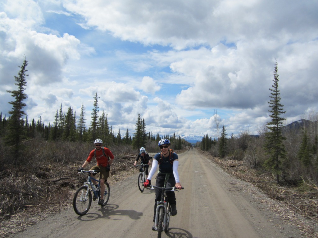
- Sunday, we rode bikes across the pedestrian/ATV bridge that connects the town of McCarthy (pop. 30) and the Kennecott Mines with the rest of the world. An old road lead us 5 miles or so up to the impressive mine site. Narrow single track took Rachel and I farther into the mountains alongside the crystal-white Root Glacier, with excellent views along the way.
- Monday, Rachel and I drove slowly back out the McCarthy Road and Edgerton Highway before heading further south into Valdez where we relaxed on Tuesday. Rachel flew back to Los Anchorage and I'm in the Vdz for another week or so with work.
 |
| Nelchina Caribou near Eureka along the Glenn. (Photo: R.S.) |
 |
| They were a bit skittish, but also pretty eager to munch on roadside browse, so our shots were limited. This was the first time I've seen caribou this close, and Rachel's first time period, so it was pretty awesome. (Photo: R.S.) |
 |
| Subaru ad? |
 |
| Sunset on Lake Louise. (Photo: R.S.) |
 |
| Driving south on the Richardson we parallelled the trans Alaska pipeline. (Photo: R.S.) |
 |
| Explaining how the line sits on sliders so it can wiggle back and forth during a quake to an audience that was already aware of this fact...(Photo: R.S.) |
 |
| Along the McCarthy Road we stopped to shoot some pictures of the Kuskalana Span, only to learn about the adhesive properties of the local geology (see the shoes). (Photo: R.S.) |
 |
The Kuskalana Span. A friend told me that years ago there were no guardrails and bungy jumpers came here late at night to the chagrin of the Park Service. (Photo: R.S.)
 |
The dry waterfall on the Crytaline Hills Trail about mid-way down the McCarthy Road.
|

Not totally dry...


 |
| Rachel looks for the best angle on some lupine off the Crystaline Hills Trail. |
|
 |
Ask Rachel what this is. (Photo: R.S.)
 |
| Overlook from the trail. |
 |
| Lana and Dan get comfortable Saturday night next to the Kennicott River. |
|
 |
| Dan and I catch up with the girls on the other end of the bridge over the Kennicott River on Sunday morning. (Photo: R.S.) |
 |
| Headed down the road to Kennecott Mine. |


 |
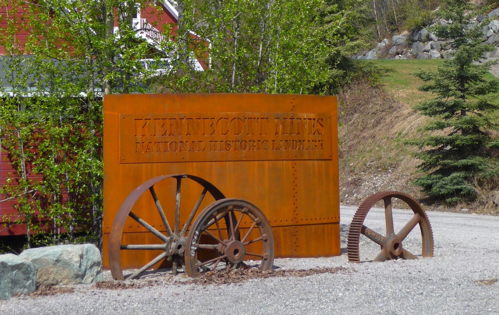
The Kennecott Mines (spelled differently then the river and glacier because of a typo) produced $100 million in profits from copper ore mines from the purest copper prospects ever discovered, to-date, from the early 1900s through 1938. Extensive mining infrastructure was built adjacent to the glacier, and the Copper River & Northwestern Railway hauled the ore to port in Cordova.The mine fed the nation's demand for copper wiring and bullets, among other things. It's hard to imagine the toils the miners and laborers faced to build and operate the mines and infrastructure year-round, and how any of it could have ever been worth it, but it's also hard not to draw parallels to the nearby trans Alaska pipeline and what people might say about oil one day.
 |
The Kennicott Glacier, seen from the mine, is at first deceiving, as its stagnant terminus is heavily crusted in rock and runs next to the mine's old tailings.
 |
 |
The mill is 14 stories tall, for perspective. The entire mine was painted red as red was the cheapest paint.
 |
The mine was all but abandoned in 1938, and nearly destroyed in the 70s before being acquired by the federal government. Restoration is ongoing, and many buildings are still unsafe to enter.
 |
The oil-fired boilers in the powerhouse ran and heated the mill. This was the place to be in winter when temps dropped to -50.
 |
|
|
|
 |
Some passing hikers took a picture of us at Amazon Gulch overlooking Root and the rock-crusted Kennicott Glacier.
 |
People on the Root Glacier.
 |
Looking up Amazon Gulch.
 |
 |
 |
| Donoho Peak. |
|
 |
Storm clouds rolled in as we headed back down to the mine. (Photo: R.S.)
 |
 |
| (Photo: R.S.) |
 |
Getting tricky with the camera.
 |
Sunset on the Kennicott River on Sunday night.

 |
|
 |
On Monday we wandered around McCarthy. The little town is also accessible by a privately owned bridge if you pay an annual fee to use, however the McCarthy Road is not maintained in the winter. This looks to be the final resting spot for this old Wagoneer.
 |
Downtown. McCarthy features a "5-star" restaurant and mud streets.

 |
Liking the decor.

 |
| A bucket, salvaged from one of the trams that carried ore from high-up the mountain sides to the Kennecott. |
|
 |
Back on the McCarthy Road headed out. The steel Kuskalana Span, was completed in the winter of 1910 in temps that dipped into the -40s and made the steel too brittle to work at times...
 |
|
|
 |
A narrow gap called the "railroad cut" in the road outside of Chitina that was once a tunnel. (Remember the road was once a rail grade, many sections are only one lane and old rails and ties still poke through the road bed.) (Photo: R.S.)
 |
The Copper River. Favorite view of the whole trip.
 |
| From the deck of the bridge leading over the river outside Chitina. |
|
|
 |
| Glimpse of Thomspson Pass. (Photo: R.S.) |
 |
| At first glance it appears that this picture didn't come out, a second look will reveal that it did. (Photo: R.S.) |
 |
| Five feet of snow at the Pass. (Photo: R.S.) |
 |
Snowcones. (Photo: R.S.)
 |
| Rachel does snow studies at the pass. She said seeing 5 feet of snow on her birthday (OK 1 day early) was one of the best gifts she could think of. |
|
 |
| A failed attempt at documenting our consumption of ice cream at 47 degrees in front of a sign showing the temp in Valdez. Well, we got the ice cream part. (Photo: R.S.) |
 |
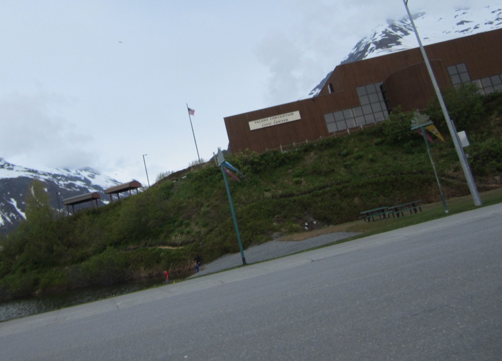
| Valdez Harbor. (Photo: R.S.) |
 |
| We tried to get a shot of some kids swimming in the pond below the Valdez Convention Center on Tuesday morning...it was in the high 40s at best, perfect swimming temp! (Photo: R.S.) |