The snow pack let out a big, long, sigh.
I looked over at T2, and we exchanged wide-eyed expressions.
The snow underfoot had just made one of the bigger collapses I’d ever seen,
heard, or felt.
-
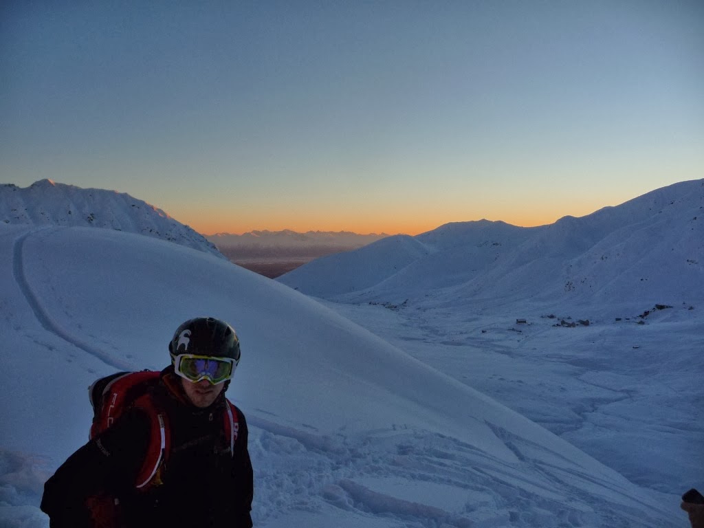
It was another sunny day in mid-April of 2013, and T1, T2,
and I were all skinning up a wrap-around ridge that lead to the summit of
Colorado Peak in Summit Pass (Peak 4539) in what I’ll refer to as “Mile-Wide Bowl,”
two drainages west of the highway.
We approached by climbing Colorado’s main east rib, before shuffling
across the flat skyline ridge, past the sub summit (Peak 4325), and onward to the
entry of a couloir on the eastern corner of the MWB.
Climbing from the highway on Colorado’s express route east
rib was solidified rock hard by wind and sun, as is typical for the aspect this
time of year, and we had experienced a little collapsing on the thin, wind-effected
snow on the open exapanse of the sky line ridge. We had also seen fractures on
the sun-cooked south face as we cruised to the summit on the main ridge; but
here, in the north-facing bowl, so far, the only issue we had was marginal snow.
A recent, moderate wind event had left behind a mosaic that
ranged from unaffected recycled pow, to inch-thick breakable crust; while ridges
were firm.
The Chugach National Forest avalanche advisory for Summit
Pass warned of the folliwng primary concern;
“With several days of mostly clear skies, cold temperatures
and almost a week since the last snowfall, the Summit Lake area mountains have
recently only been accosted by wind. North and westerly winds picked up
yesterday with plumes on the peaks (see photo below). Amazingly enough however,
much of the
terrain we found had escaped wind effect and the riding
conditions were quite nice.
That said, keeping a close eye for cracking at the snow
surface and areas with recent wind affect will be wise.
Places most likely
to get tangled with a wind slab will be in the upper elevation steep terrain.
Quick hand pits, ski cuts and feeling for stiff snow over light snow with your
pole are good techniques to use while traveling.”
We entered the bowl by skiing a zig-zag, rock-strewn couloir.
It skied like garbage due to the breakable. When N1 ski cut the run, we jumped
at the sight of what we thought was a fracture, but closer inspection revealed
it was in fact a large, broken piece of harmless wind crust, perhaps an inch
thick, sitting on the buried powder.
At the bottom of the run, even though the skiing sucked, we
decided we were far enough back, and the MWB had so many options for a better
day, that we would at least do recon and take pictures.
The MWB is sort of divided into an east and west half, with
the conical summit of Colorado Peak cutting it roughly in half. We dropped down
to the bottom of MWB, and climbed back up a wide gully to the far west that
brought us into a small, intermediate basin, below and west of the summit. To
the climber’s right was a steep slope punctuated with rock outcroppings, ahead
was an open bowl run beneath the peak, and to the left was a wrap-around ridge
that lead most the way to the summit.
We might have been content to snap some pictures and ski out
of the intermediate basin via a short but steep couloir we had eyed earlier,
when we heard T1 holler from the summit.
T1 started an hour and a half behind us with the plan to
sync up, and had just reached the top. He dropped off the summit, and we were
surprised to see him carve descent turns on the northwest-facing aspect.
Fully grouped, we decided that T1, T2, and I would head for
the summit and farm T1’s tracks, while N1 wanted to boot the climber’s right
face and ski the outcrops. We would have a visual on N1 the entire time, and
vice versa, along with the ability to yell back and forth if needed; but N1
took a talkie for some extra assurance.
The wrap around ridge was the safest way to the summit by
your standard textbook definition of safe travel in avalanche terrain: Isolated
from the adjacent terrain, it lifted us first up and out of the intermediate basin,
before climbing steeply to the summit.
The ridge, however, was firm – though not as bakes as the
express route east rib –opposed to the powder-to-breakable snow found in the
bowls and couloirs.
I clicked into my ski crampons, and headed upward on a vertically-inclined
uptrack.
T1 and T2 cut their own skin track at a more moderate grade.
About 300 feet above the floor of the basin, we reached a
point where the ridge subverted into the steep summit cone.
The snow was getting very firm now, but the grade was too steep
for my ski crampons to hold any more.
T2 was about 20 feet behind me, and T1 about 20 feet further
back from him. I turned around to T2 to say that I was thinking about kicking
steps the rest of the way up to the summit.
He suggested we just push out into the bowl where we would
find easier skinning in the softer snow.
Though your textbook would say this would open up our
exposure, nothing indicated this latter option to be a bad decision as far as
snow stability was concerned, and we agreed that would be a good plan and
easier than booting.
I might have taken two steps when the snow collapsed.
-
For a second, it wasn’t clear if the snow would slide or
not. The ground just seemed to tremble. It may have slid a bit, and even
stopped for a fraction of a second, I don’t know.
Suddenly, the slope started a slow-motion disintegration into
blocks.
Someone might have said “here we go,” and I saw T1 and T2
turn on their tails and start trying to ski on their skins with their risers up.
As the snow broke apart beneath us, I was still facing
uphill, and my feet sank down about 6 inches to the bed surface where the
crampons bit in.
Between the shaking and the biting in, I was easily knocked
forward, first onto my knees, then hands, then sprawled out on my stomache.
I started sliding down; the ridge growing upward before me.
All the while I was trying to keep eyes on T1 and T2 as they
fought awkwardly to stay upright.
What commenced was a sometimes strange, though very
articulate internal dialog.
“Wrong role. You’re in this. Stop Watching T1 and T2.”
Blocks of snow anywhere from a few inches to 16 inches thick
were jostling next to me. A few bounced against my head and face, momentarily smothering
my breathing with dry powder.
“This is bad! You’re not supposed to be laying down!”
I could feel my hands and ski crampons scraping along the hard
bed surface.
I flipped my poles upside down and began stabbing the
handles at the bed surface as if I had a wippet, which I regretfully did not.
They would bite in a little bit, and I could force weight on
them, but it was not enough to hold purchase, just act like plastic brakes on a
child’s sled.
I kept at it. Over and over I would stab, hold, drag,
release, and repeat.
I was able to start slowing down.
Blocks of snow began to pummel me in the face and slide by. I
knew that strangely, it was a good sign, and I was moving slower than the
surrounding snow
I felt like I was fighting, and that gave me some sense of
hope and confidence.
My head was still on a swivel, gauging how far I had slid,
what was going on below me, and where T1 and T2 were.
I saw that both of them were still fighting like hell to
stay on their feet.
Undoubtedly they were trying to keep from going over the
other side of the ridge down into the main basin. That slope, just out of my
sight, was a veritable cheese grater of Chugach shark fins.
I could feel the snow trying to pull me off the other side
of the ridge and back into the intermediate basin. I was less worried about
rocks, but more worried about getting buried in the basin.
Thoughts continued to swirl through my head.
“This slide is 1.5 feet deep.”
“It’s not going very fast. It feels like it might stop any
second, but it won’t. Why not?”
“Keep stabbing. You gotta stay on this ridge. Don’t go over
the side!”
“T1 and T2 are fighting hard. They really can’t go over that
other side!”
“Is my beacon on?”
“I think I could reach into my jacket and turn it on right
now.”
“Are you fucking serious?”
“Why would it not be on? Have you ever skied with it off?”
“Dumb question! Focus!”
“I can’t believe I spent a week in the Alaska Range and I’m
about to get killed back here.”
“FOCUS! Keep stabbing!”
As my head whipped up and down and around, I noticed there
wasn’t as much snow moving above me anymore, but below me, chunks looked like
they were piling up in the basin and starting to slide out across the floor
toward the wide gully we climbed.
Meanwhile, I felt like I was losing my battle to keep from
going into the intermediate basin.
Finally, I got too close, and felt the incredible pull of
snow and gravity take over.
If I had any premonition that I had some kind of control, it
was gone immediately.
The feeling wrenched the confidence I thought I had seconds
ago right back and left a gaping hole filled with fear.
“If this slide runs through the intermediate basin, it could
keep going down the gully we climbed up…this could get really bad.”
“This is starting to hurt.”
I was moving too fast to stab at the bed surface with any
effectiveness, and accepting that I was going down to the bottom, I let go of
my poles.
“Goodbye poles.”
“Will they still be here in the spring?”
Who cares?”
“Time to start thinking about taking deep breathes.”
“Cover your head, curl up, and get ready.”
“What is this going to feel like?”
“I’m scared.”
“It would be good if this would just stop now.”
Silence.
The slide stopped, leaving me 10-15 feet over the end of the
ridge, and maybe 200 feet from where it all started, just out of sight of T1 and
T2.
“Were they still fighting on the other side of the ridge?”
“SLIDE!” I yelled.
I really don’t have much in the way of a sense of time, but
it had probably been about 15 seconds since the initial collapse. All three of
us were so close together when the slope let go that not a word was exchanged.
In retrospect, yelling was kind of funny, but in my mind, I
was worried that somehow N1 had not seen the incident and might still be able
to spot T1 and T2 if they were still in the mix.
“I’m OK!” both T1 and T2 yelled.
T1 and T2 stayed on their feet and stayed on the ridge. Both
of them came to a stop bit higher than me.
“Is everyone OK?” N1 yelled from across the way.
He had heard the initial settlement, and watched the whole
thing from a stadium seat.
-
The initial collapse was a slab that fractured maybe 15-20
feet wide about 20 feet above T1 and I, about 6 inches deep. The shallow slab
probably slipped, partially arrested, before triggering a deeper slab that released
below us and went much wider to about 1.5 feet deep; hence the slow start. The
width was hard to judge, but probably about 100 feet wide at its widest, though
as narrow as 15 feet near the top, and the debris had run about 300 feet to the
floor of the intermediate basin, piling in blocks to about three feet deep at
the absolute deepest.
By all accounts, the slide was rather small.
Once the main body of the consolidated slab hit the flat
basin and encountered the unconsolidated powder and breakable in the sheltered
bowl, it ran out of energy and cohesiveness.
-
T1 and T2 traversed around the ridge to where I was. T2
stopped, and banged a newly exposed rock with his pole along the way. We were
lucky none of us found any of its neighbors.
We reconfirmed that everyone was OK, and got on the radio
with N1, who was preparing to make his drop to meet us down below. He had made
it a comparable height up the other side.
N1 said later that from his perch, he knew within seconds
that no one was at risk of deep or even full burial, but he was very worried
about trauma, especially if anyone went over the cheese grater.
T2 announced this was a fine time to have lunch, and plopped
down on a block of debris to dig out a juicy burger from his pack.
I dug down 8-10 inches below where I’d stopped and found my
poles, shook the snow out of open pockets and the open side zips of my snow
pants, and began to transition.
That was it, it was time to go home, we’d seen far more than
we bargained for.
 |
| Looking down from where I stopped. My pocket was open and my camera lens was smeared with snow. |
So what happened? Was this one of those, we ignored all the
clues?
A lot of people involved in slides will report that
everything told them to go home.
As we discussed the events, no one seemed strongly of that
opinion.
We had seen tell-tale evidence of instability on the flat,
wind-whipped sky line, and on the sun-cooked south side, but north-facing was
fine – though lacking in quality.
The avalanche forecast had warned of wind slab issues, but
wind slabs are a fact of life in the mountains, and something we deal with
regularly.
From a terrain management perspective, we were also climbing
the least exposed line, staying high and above the typical avalanche paths – in
theory anyway. In retrospect, we would have actually been safer out in the bowl
or booting a couloir where the snow was not slabbed.
That being said, I think we made some small errors that did
not help us:
1. Long term impact from
recent weather: Four weeks prior, in late March, a warm and windy storm
rolled through that formed what would become a persistent and lousy base
throughout Summit. A few days after “storm 2,” came in, depositing a descent
snow fall, accompanied by more moderate winds than the previous storm, resulting
in numerous naturals that I and others observed in north facing terrain
throughout Summit Pass.
Smaller storms and a lack of wind
was briefly able to rebury the persistent base without loading slopes enough t
trigger the same number of widespread naturals through the early part of April.
In the past two weeks though, the snowpack
had been subject to a prolonged and unseasonable warm and dry spell that formed
crust into the high elevations, only recently covered by a light storm, earlier
in the week prior to our slide. After this recent storm, clearing skies brought
moderate west winds that created the variable snow quality in the bowl, and
firmed up the slabs on the ridges.
It was a carbon copy of storm two
back in March, in which a large number of naturals were triggered.
Adding to this, we were two
drainages west of the highway, and though we had elevation on our side, the
snowpack was notably thinner and drier here than it was in eastern Summit Pass.
We were treating this snowpack much like we would have the snowpack on Ravens
Ridge or Spiritwalker.
2. Aspect orientation: Though
our ridge was in a north-facing bowl, it’s final pitch ran at north-south
axis, allowing it’s west side to sit in the afternoon sun. Temperatures
had swung back to the cool side in the last week, and were running from
the low single digits to negative single digits at night, to high 20s
during the day. The cold dry air was rotting out weaker snow under the
newly formed slabs, and daytime warming was making for more reactive
conditions later in the day, with the caveat that the major indicators were
absent (i.e., even on south faces there were few natural rollers or
pinwheels because of a gentle but steady northwest wind).
3. Our travel techniques were
poor. I prefer more of an “SFU” approach when traveling on wind slab, as
lateral traversing on a splitboard is tough on my ankles. My crampons let me pull steeply up firm
snow. T1 and T2 cut their own skin track at a much more reasonable grade, but
we were effectively isolating segments of the slope below us. I should have dialed back my approach. The ski crampons also let me sidehill easier.
When the grade steepened, T2 came
up next to me so we were standing on a slab on a steep slope next to each other.
I don’t fault T2 for this at all, I would have done the same thing to discuss
our route options. Our combined weight probably helped to collapse the slab
though.
4. Lastly, thanks to a
picture N1 took from across the bowl, we were able to see that what looked
like an isolated ridge from below, was actually more of a planar wing. If
we truly stayed at the narrow apex of the wing, we likely would not have
triggered the slide, but the farther one steps out off the apex, the
deeper into the slide zone they enter. When I saw this pic a few days
later, I said “duh, of course it went, how could we be so stupid?”
That being said, views of slopes
from different angles can make them look wholly different. That is to say, from
below, our route appeared far more reasonable than it may have from N1’s
vantage.
 |
| When viewed from the bottom of the intermediate basin, our route selection look fairly straight forward. The crown is hard to see because of lighting. We are circled. (Photo: N1) |
 |
| View from N1's vantage and the story seems more simple. (Photo: N1) |
Personal takeaways:
1: Group travel. Skiing is social. There are times and
places for piling up and chatting, but more often than not, the thought process
should be: “Are we spaced out enough?”
For the rest of the spring, I was notably more snappy if
anyone got too close to my tails.
2: Spatial awareness. I got a lot of days in last season,
and I feel comfortable with my terrain management skills. Sometimes, I confuse
this confidence and comfort into my decision-making process. I’d do well to be
more weary when we push into someplace new, and ask twice about route
selection. For example: “This is the safest route up by definition. What could
still go wrong? What are our alternatives and are they safer or more dangerous?”
3: Think about the slide. Billy Finley nailed this one on
the head last spring in an essay on his site. Sometimes, you can do just about
everything right, and it still goes wrong. So long as you are pushing it,
eventually, something is going to happen. I think I have a healthy amount of
respect for the mountains, and fear is often my companion. That being said, as
with so many other backcountry travelers, too often my only train of thought is
avalanche avoidance, and not avalanche action and response as well. We don’t
often think about how our current dress, gear load, topographical position, and
location relative to our partners will impact us in a slide or after. Not all
those factors are controllable at any given time either. Nonetheless, certain
lessons were well worth paying attention too. My crampons would have made it
impossible for me to ever ski downhill. In a bigger slide, or in more exposed terrain,
I should probably think about exiting my bindings as a first course of action
in a slide. Also, if I was using crampons, why didn’t I have a whippet?
My snowpants were zipped open at the legs to vent. When I fell into the mix,
they began to fill with snow. Had I been buried, this would have expedited hypothermia.
Old timers sometimes say, “wear what you want to be buried in.”
I can’t say I’ve figured out how to keep heat in check and
still keep layers on, but its something to work on more.
4: We were really lucky: No, not just because we lived, and
no one was hurt, but because the experience was incredibly enlightening. I
would never tell someone to jump into a slide, but I also could not have asked
for a more hands on experience. I have made assumptions about what happens in a
slide from what I’ve watched in the mountains, and listened and read of other’s
experiences, but nothing will replace being there. The allusion of having
control, the bouncing along on the bed surface, the thought process, they were
all lessons learned and stored; though all slides are different, and none are
worth tangling with in the end.