Prelude: Kyle first mentioned going to Adak to hunt caribou
a year ago and it sounded like a pretty incredible adventure.
North American interests in the Aleutian Island of Adak were
essentially non-existent until the Japanese invaded the islands of Attu and
Kiska to the west in 1942. Adak, which had formerly been home to a small native
Aluet population and some Russian fur traders, was used as a strategic
launching point for the US military to push the Japanese out of the Aleutians.
In the following decades, it became the site of a massive naval base that
housed 6,000 people at its peak, before closing down in the mid-1990s.
Perhaps 50 people live there now (The official Census number
is bull, I’m sure), along with some transient fishermen and federal employees,
a few Alaska Air personnel, and the burliest eagles and ravens I’ve ever seen, plus
hordes of invasive rats. Oh, and there are some 2,500 caribou too.
The latter were intentionally brought to the island from
mainland AK shortly after WWII to serve as a sporting opportunity for personnel
stationed at the base, and as a backup food supply if needed.
After the military left the island, the caribou population
exploded from a few hundred to a peak of 3,000.
The habitat on the island is ideal for an ungulate evolved
to thrive on barren tundra plains: an ample and rich food supply, mild weather
(by caribou standards), and most importantly, no predators.
The US Fish and Wildlife Service has debated exterminating
the herd (good luck with that) to keep the animals from invading neighboring
islands, but the hunting provides one of the biggest tourism draws to the
island, and the locals protested. Hunters are limited to two bulls and as many
cows as they can take a season.
That being said, this wasn’t going to be a turkey shoot, and
we all knew it.
Alaska Air flies to the island twice a week under federal
contract, and we were to go in on Sunday the 22
nd, and come back out
the following Sunday.
Unsurprisingly, a seasonably strong Bering hurricane set up
shop in the region the week prior – there is almost always some type of cyclone
hanging out in the Bering – and on the day of our flights, the island was
getting pounded by 100 mph winds. The plane didn't fly, and it appeared we'd have
to wait until Thursday, the next scheduled flight, to get in. Thursday to
Sunday was too short a trip, and Thursday to Thursday didn't work with my
schedule, so I bowed out at noon on Monday.
Five minutes later, Alaska Air emailed us to say we were booked
on an unscheduled flight the next day.
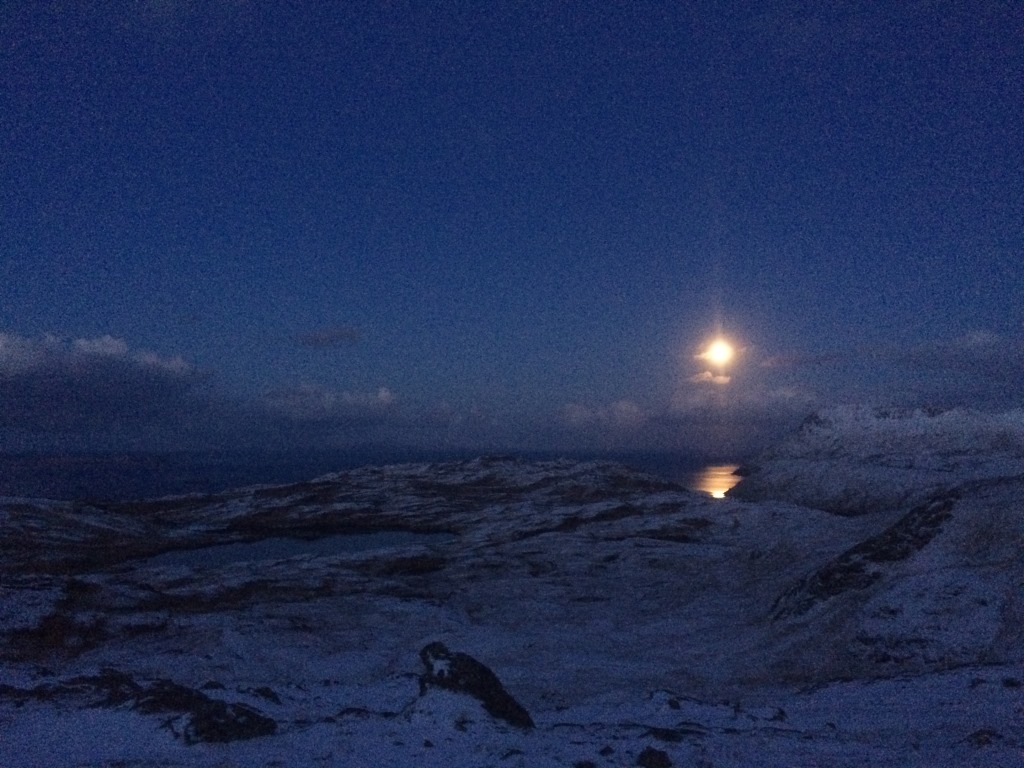
Photo note: Adak scary wet weather kept my camera tucked away the whole trip, but Logan captured the entire trip. All photos in this post are credited to Logan.
Day 1: the flight in was non eventful. Far better organized
than we had been on Sunday, we checked in and boarded the 737 freighter/passenger
combi for the 3-hour, 1,200 mile flight. We cruised over an endless plain of
fog and clouds, occasionally catching glimpses of a green Bering Sea and brown
volcanic islands below. Adak airport terminal isn’t much bigger than a single-level
family home. If, somehow, there was ever a full 737 of people leaving, it’s
hard to imagine they could all fit in the building while awaiting the plane’s
arrival. A man wearing camo army fatigues named Mike held a piece of paper with
Kyle’s name. He showed us our early 90s Isuzu Trooper rental, which, though smelling
of cleaner, still had some caribou blood and tufts of ptarmigan feathers in the
back.
You have to fly all your own food out to the Island, so
along with guns and duffels, we also each had a stacked set of plastic totes
full of food. We brought out 16 totes total I think, hoping to come back with
them full of caribou.
Adak has a number of housing complexes, almost all of them
abandoned and slowly giving in to the hellish weather. Our quaint block was one
of the few inhabited streets. The homes are set up to for your average American
family and their 2.3 children. Wind-blasted playgrounds and a faded and blown
out McDonalds are stark reminders of this place’s history.
The houses, and its neighbors, were a stark juxtaposition to
the surrounding landscape. While comfortable – we had hot showers, a
washer/dryer, and full kitchen – the disrepair was obvious enough. Rats had
chewed through one of the front doors, the gusty winds drafted through and sucked
out any heat, windows were opaque from moisture leaked between the panes, and
we heated the unit with the electric oven as only a few of the base boards gave
off heat.
The house received a short inspection, but with 2 hours of
daylight on the table, no winds, and sunny skies, we moved fast and went for a
recon hike from the Husky Pass trailhead. We moved slow and hoped to maybe see
signs of bou or shoot ptarmigan. We succeeded at neither, but we learned a bit
about the minutia of the topography, and the “character” of the trails.
It was gorgeous out too, though I think all of us were a bit
surprised by the cold. Temps for the trip ranged from maybe 29 to a 35, but
winds and high humidity combined with near constant precipitation make this
place a hypothermia factory.
Day 2
Overnight the wind began to howl, as forecasted. We shuffled
out of the house in the 7:30 dark – Adak is on Hawaii Time, and sits at the
same latitude at Vancouver Island, first light was a bit after 8, and last
light was around 630.
Thick snow was falling in every direction but down. Logan
slowly drove the Trooper to the Finger Bay trailhead. The tired headlights of
the rig barely pierced 10 feet into the melee. The road twisted its way up and
over a ridge. Unable to see beyond the rotten wood guard rails, we pictured a
frothing Bering Sea just beyond, waiting to swallow us and the Trooper if we
slipped off one of the icy bends.
Eventually we came to a switchback where the road narrowed
and dropped down a steep icy hill to the waters of Finger Bay. We parked and
walked into the storm. Walking over a narrow telephone pole placed over a
stream and adorned with basically decorative rope railings, we crossed the
inlet and wrapped around the bay’s opposite side.
We found shelter from the wind here, and the snow fell in a
heavy, wet, apocalyptic curtain. We thought maybe we had picked a good zone: winds
were forecasted to build to 50mph by the afternoon but we were sheltered.
The side-hilling hiking trail was, as with other trails of
Adak, a suggestion. “Trails” are generally unimproved, barring a rare repurposed
chunk of wood or steel pipe placed over particularly nasty obstacles. Footing
on trails varies as much as off trails: spongy tussock, slimey mud, and knee-deep
muck holes abounded.
Eventually we steered up a wide draw to cross into the
neighboring Susie Lake drainage. Our slow gain in elevation brought us head to
head with shrieking wind. Forward progress ground down as we waded through knee
deep snow drifts that occasionally covered even deeper holes filled with mud,
water, or just more snow. At the high point of the plateau the wind hit us head
on with 50mph gusts that pushed us backwards and knocked us down. A mere 400
feet above the ocean, we battled an environment one would expect at 10,000 FSL.
We worked as hard to go downhill as we might otherwise to
have gone up. Eventually we lowered down enough for the winds to abate some,
but were still fierce. Visibility was limited to a 1/2 mile. In an effort to
think like caribou, we scoured sheltered draws. Our search yielded nothing
though, and it became apparent as we headed into the funnel of another valley, that
if we found any caribou, we were just about going to have to head butt them. Drenched,
our faces raw from the relentless pelting, we turned around. Walking with the
wind brought relief from the face-peeling rain/sleet/snow, but the same wind
knocked us forward and threw all of us into holes or tumbling over tussocks we
meant to avoid. Warming temperatures turned the footing underfoot to messy slush.
We made it back the car 4 hours after having left, all of us feeling destroyed.
At the same time, we had to give ourselves some credit: We gave it an honest
shot.
We worked the ancient drier at our house hard, and fired up
the oven to provide heat as the wind sucked away what minimal amount the few
functioning baseboards put out.
In retrospect, we’d later realize, we should have stayed put;
but fresh to the island, we were eager to get out. Had we already been on the
island a few days, we might have recognized that the storm would have been a
fine time for a needed rest day.
Day 3:
With the worst of the storm largely passed, we went back to
the same TH. This time we were headed to Betty Lake. After climbing the steep,
muddy hill to the lake's north shore, we split. Kyle and I would take the east
shore, Logan and Abe the west. First though, Kyle and I had to get across the
lakes’ outlet stream, which poured through a steep rock canyon. With no obvious
way to hop the slick rocks over the fast moving water, we straddled a piece of 12-inch
rusty pipe that was lain across the gorge, and humped our way over. On the
other side, we sidled along a wall of wet rock on a thin muddy strip of wet
grass: below was a 20 foot drop straight into the icy water.
The shenanigans came to an end, and we began to move up and
down the low ridges that separated the draws flowing into the lake. From each,
we glassed ahead, searching for any sign of life: tracks in the snow, beaten
down vegetation, scat, skeletons, better yet, an animal.
Nothing.
If there were caribou here, it was so far mysterious.
Eventually we decided we were wasting time, and scurried up valley to the head
of the lake, and then upward into the cloudy and blustery Gannet Pass.
Somewhere on the way up we heard at least 2 muffled thuds.
We were near a gushing stream though. Was it a gunshot, or just a shifting
rock?
Eventually we topped out in Gannet in the rearing wind. It
was here we finally saw evidence of bou: an old track in some gravel. It was
noon, and before we slipped over the pass, we radio checked with Abe and Logan.
Logan answered immediately.
He could hardly hear us, but we could hear him loud and
clear.
"Bou down," he reported.
He didn't need help dressing the animal, and Abe was
pursuing the remainder of the group they’d come across, so we let him know we
planned to slip over the pass and out of radio contact. (Note: using radios to
hunt is illegal. We used the radios solely for safety and keeping tabs on each
other.)
Over the pass, we ducked down into the lee of a large rock
with a perfect view of the Gannet Bowl. A veritable slaughter alley lead in
just below us, and we had a great vantage over it. The on and off assault of
sleet and rain seemed to abate, so we waited for a half hour.
Again, glassing, there wasn't a sign of life in the entire
bowl: no obvious trails in the brush or tracks in the snow. Eventually, we had
to move.
At this point, I had a real problem. My right knee was
killing me. It had ached the day prior, but by the time we reached Gannet, it
was getting toward serious. Side hilling and steep climbing were the worst, and
I was fearful a bad step or deep plunge would be catastrophic.
Getting injured was no joke out here. There's no rescue, no
evac, and the terrain is nasty enough that getting out on one leg seemed close
to impossible. We had gear to emergency bivvy, but the odds of surviving a
night alone seemed close to 0.
I loaded the gun on my pack, as it was throwing me off
terribly, and Kyle gave me his collapsible trekking poles. Though mostly
mental, the added stability at least allowed me to move from ½ Kyle’s pace to
closer to 3/4.
I felt pretty bad though. I was useless. If we shot an
animal, there was no way I'd be able to help take it out.
We covered the ridge between Gannet and Hikers pass, where
we found the tracks of the group of animals Logan and Abe had likely found. We
were excited our friends had taken a bou, maybe more, and happy our Thanksgiving
dinner would consist of fresh meat and not deli turkey. Seeing the animal
tracks too was a confirmation that in fact, there were animals to be found.
That night we ate an awesome Thanksgiving dinner: mashed
potatoes and brussels sprouts from Logan's family’s farm, stuffing, and caribou
backstrap and liver. Logan wanted to make the liver in particular, and it was
the standout in my opinion. Prepared with leeks, it's consistency was like that
of a sautéed mushroom, but thick with a rich flavor. I really liked it.
Day 4:
With my knee aching, I took a needed rest day while the boys
went on a really long hike that took them through Hiker Pass to the far side of
Gannet Bowl and back over Gannet Pass. They spotted a few bou mid-day, well out
of range, and had the best weather of the trip to that point, with ample breaks
of sun, but the odds of bringing home more than one animal seemed to be slipping
away.
Day 5:
Logan had joined the knee pain train with me, and Kyle and
Abe set off for what they expected to be an epic hike, but not much else, encircling
Mount Reed. Logan hobbled behind Kyle and Abe until about 2/3 the way down the
backside of Husky Pass in a sopping wet white out, before heading back. Coming
down the front side of Husky, he found 8 caribou nearly within sight of the car!
He attempted to get into position, but the gusting wind easily gave away his
cover, and the herd put miles into him in no time. A little dejected, he got
back to the house mid-afternoon, and an hour later, we both headed back to the
TH to see if the bou came back, and to try and plink ptarmigan while waiting
for Kyle and Abe to return from their trek.
The hard rain and wet snow that had fallen all day yielded
to a beautiful evening, but the bou didn't come back, and an hour after full
dark, there was still no sign of Kyle or Abe’s bobbing head lamps on the
distant horizon. Around 7:45, after flashing the Lake DeMarie Bowl with a
bright lamp for a bit and seeing no sign, we drove down the road to Heart Lake
trailhead, thinking they may have gone for the nearer TH.
Stupidly, we had left the second radio at the house when
Logan came home, but confident our friends were at least a 1/2 hour out, we
bombed down to town and grabbed the talkie, food, and extra clothes. I
secretly hoped they had come out the other TH and caught a ride back to town
with the other group hunting the island, but no such luck.
Back at the Husky Pass TH, we kept shining the bright head
lamps and shot the .410, radioing to no one.
It was starting to get late.
While we joked, and hoped, that they had massacred some bou,
and were huffing them out, the very real reality of a situation began to set it.
After waiting at the Husky Pass TH for some time, we again
headed to Heart Lake TH. With 930 drawing close, we began the very serious discussion
of what to do about our competent but likely lost friends.
We fully trusted their decision making. Abe had an InReach. We
knew if there was a serious problem, he’d likely activate it, though we weren’t
sure if we’d receive any notification. Of course, we knew that professional
rescue, if needed, was hours away anyhow, and would be of little value until
the next day.
If they were lost – which seemed unlikely – or injured but
not seriously, they might have to biv. Biving seemed like the worst situation.
We didn’t want to initiate our own search, as they could
come out from either direction from their circular route, and we could easily miss
them, and the last thing we needed was two parties groping around a
storm-battered island in November at night.
We planned to wait until 10:30, at which point, we’d notify
Mike, and prepare for a search in the morning.
We kept radioing, hoping they would respond.
Then the radio crackled a bit.
A few seconds went by.
“We got caribou bitches!”Abe huffed into the radio.
Three-quarters the way around Mount Reed, mid-afternoon,
after seeing virtually nothing all day but a rat swimming in the sea, Kyle and
Abe located, stalked, and cornered a herd of 4 caribou onto a small peninsula.
Cue Boondock Saints: “THERE WAS A FIRE FIGHT!”
They positioned themselves on a perfect knoll and took blasted
the whole group.
It wasn’t until 8 that they had finished quartering the
kills and began the pack out in the murky dark.
Their route was obviously inefficient since they couldn’t
see where they were going, but at last, to our relief, their distant bobbing
lights came into view beyond Heart Lake basin, and we headed out to meet them
for the final stretch.
There were still 6 more loads left in the field, protected
from the hungry ravens and eagles that would soon descend on the scene.
Day 6:
The next morning we were back at the TH, and with the first
tinges of daylight spreading across the gray sky. We trucked to the kill site
in only 45 minutes with empty frames. We took out the heaviest loads, and with
the Trooper loaded, Logan and I headed back to town to begin a frantic carving
and packing session while Kyle and Abe retrieved the final two quarters.
Somehow, who even knows how, we had 12 totes packed to the
50 pound airline limit with bou, plus all the guns and gear bags, piled in the
airport by 4. Mike saved our tails, and helped truck out the bones and spines
while cleaning up our disheveled mess at the house. It wasn’t our plan to be so
hasty and leave such a mess.
I was impressed though: he’d noticed we were missing the
night prior, and was really concerned when the Trooper was gone again early in
the morning. When he found out why though, he was thrilled with our success.
At last, we plopped into our seats on the nearly empty 737,
blood smeared on our pants and jackets, beat down to hell, but all smiles and
stoke.
Thoughts:
This was a really unique trip.
I don’t hunt and have never claimed to. My interest was
based purely in the adventure and the prospect of bringing home some caribou. Whether
I killed a caribou myself was irrelevant.
That being said, I can only think of one other reason I’d go
to the Aleutians: some kind of misbegotten mission to ski every island’s
volcano (rad in theory, probably hell in reality). Every synonym for harsh and
wild you could use on this place will fail to deliver how raw it can get.
Every park from Glen Alps to the Everglades has some stupid
warning about wearing warm, waterproof clothing, and being ready for inclement
weather, “because the weather can change fast here!”
All those places can quite literally go take a hike. There
was no singular weather on Adak, it was just constant. We had same some pretty
heavy weather at the beginning of our trip as the remnants of a tropical storm
In-Fa “breezed through,” but it wasn’t by any stretch abnormal, and didn’t even
hold a candle to the cyclone that had deflected out initial flight. In fact, it
was totally normal. What is normal weather on Adak is a crisis situation and a
state of emergency in most places. More, what is happening now, or 15 minutes
ago, likely has no relevance to what will happen in the next 15.
If the weather isn’t bad enough, the terrain is worse. It’s
just a tussock minefield perched on volcanic ash goo. Solid ground is rare, dry
ground non-existent. The winds can defy gravity here. We literally watched the
wind blow a waterfall right back up a hill in Gannet Pass. Wetness and a chill are
constant. Route finding is easy if you can see, but it’s slow-going and tough
on joints. I don’t hike much, and it showed.
You can rent 4-wheelers, but only a small part of the island
is legally accessible. If you’re skilled in driving them, they could be a great
asset; otherwise, they seem like more trouble than they’re worth. The terrain
is easily shredded by their passage, and the ATV “trails” were just ugly, gnarly,
wide, torn out mud ruts.
In retrospect, I think a good tactic with four people would
have been to alternate days in the field: 1 day, a pair goes out, while the
other pair rests and stays close to the roads, maybe looks for ptarmigan if it’s
nice, or processes if there’s a kill. If the in-the-field group make kills – it’s
a good idea to drop multiple animals is possible – they could use an InReach or
sat phone to communicate with the resting pair and give a GPS location so they
can get some help packing out. Abe might have used the InReach to text Logan
and I of the situation if he could have, but the device was inadvertently
turned on and its battery had dies. AT&T users have basic cell service near
town and can text and call.
Verizon has
no service at all. The idea though, is that the hiking and weather are tough
enough. Alternating rest days would save up energy.
Would I go back?
If you asked me mid-trip when my knee was so stiff I
couldn’t go up or down stairs, and was scared about the future of my ski
season, the answer was a resolute: hell no.
I think now though, I would.
Would I recommend it though? Maybe to like 5 people.