Mile 0

and mile 5,476

My trip to Sterling began early on Saturday May 24 in East Middlebury, VT. With the back of the Subaru sagging noticeably from the weight of my most prized belongings I started off on my westward leg to the Oregon. The first day was more of a continuation of the previous week, saying goodbye to my old haunts in Saratoga Springs, and trodding over familiar grounds on the the New York Through Ways. Accompanying me on the westbound portion of my trip was my girlfriend Leila, who had a flight back east from Seattle on Thursday night. Our route followed I90, joining with I 80, which we continued to follow after it divorced itself in Illinois, through Iowa, Nebraska, Wyoming and Utah. Just outside of Salt Lake we jumped on I84, following it through Idaho and Oregon to the coast.

Of the numerous discoveries made on this trip Leila and I made, one of the first was that there's not much for us west of Ithaca NY until at least the continental divide. "O-hi-only want to die" through "I-owana die now please" came in dead in the points competition of this trip. Ohio through Illinois kept us moving on with their strange smelly factories and characterless sub-divisions, while Iowa thunderstorms scared us enough to send us backtracking one night outside Des Moines in search of shelter from deadly thunderstorms. To Iowa's credit however, I had the best steak of my life in Davenport, and we were warmly welcomed by the Inn Keeper in the isolated exit of Victor. Nebraska, though certainly not a place I'd like to live, surprised me with it's tranquil beauty. The soft rolling hills leading up to the Continental Divide in Wyoming, dotted only be the occasional herd or grain silo felt soothing to cruise through.
Wyoming felt much the same. We were greeted with flash flood alerts the night we got in, and awoke to temperatures in the lower 30's with fresh snow on the crests of hills. As we made it further in we noticed obscure towns with booming construction. The high gas prices are probably fueling growth in areas where natural gas wells once deemed unprofitable have again begun to produce. At one point we jumped off the highway for a fuel break, only to find when we returned to the on ramp, that it had been blown-up! The highway crew was rebuilding it and we were forced to go several miles west before getting back on.
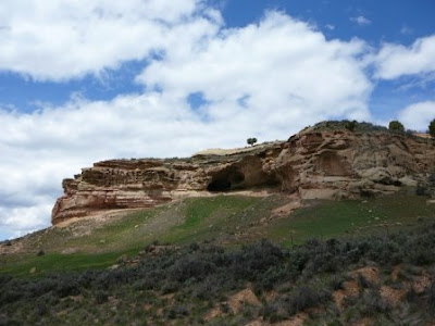
In Western Wyoming we got our first view of the Wasatch Range in Utah.

The pictures of Utah, speak for themselves.


We passed through most of Idaho and Oregon under the cover of clouds and rain, finally hitting Portland on Wednesday Afternoon, just in time to get stuck in the middle of the evening commute. After dropping Leila off to spend the evening with her sister, I headed south to Blachly, about 45 minutes northwest of Eugene to see my friend Rachel, who's spending the summer working on a small organic farm there. Her new digs, a barn partially converted into living quarters, and 4 barnmates were all very cool.

Thursday morning Rachel and I went for what would have been a sunrise hike on a nearby ridge, but the coastal mountain fog left the area socked in. When we got back to the barn her mates had cooked up surprise birthday breakfast.
At 3,338 miles, Blachly marked the end of my western leg, and the beginning of my northern leg.

After picking Leila back up in Portland Thursday morning, we shot up I5 to Seattle. I left my car in the SEA-TAC airport garage and we caught a bus into the city. Seattle, at least as a physical city, reminds me of a west coast Boston. Fairly small and compact, it might still be a little big for me, but I could see myself living somewhere nearby. The highpoint of the afternoon was visiting the Pike Place Market, where we must have spent a good 3 hours sampling "chocolate pasta," dried fruit rolls, fresh strawberries, raspberries, peaches, and of course, salmon for me.
The low point came several hour later at the entrance to the security check point in the airport.
Leila and I had both gone into the trip believing that after a week in the car together, we'd be so sick of each other we'd be ready to go our own separate ways. While neither of us had actually wanted that, we both sort of assumed that would happen. Instead, we found ourselves closer, and goodbye even harder than expected. I don't know what the first leg of the trip would have been like on my own. With nothing to see, no one to talk to, and no one else to watch my back I think I might have just turned home some where west of Ithaca. I can't thank Leila enough for making that first part of the journey with me, and only regret, for both our sakes, that she couldn't have gone all the way north.

Friday morning, feeling as cold as the steely gray Seattle sky, I headed north on I5 to Rt 2 east over Stevens Pass.

The elevation lifted my moods, and the 10 feet of snow I found at the base of Mission Ridge Ski area made me regret that I so desperately need an oil change before the weekend.


After stopping in Wenatchee for an oil change, I jumped on Rt 97 north. Driving through the mountainous high dessert, with the temperatures up near 90 and the glimmering waters of Lake Chelan to my right, I felt more like I was on the coast of southern California than the center of Washington State.

I spent Friday night camped out in Winthrop, a ways up the eastern side of Washington Pass (Washington Rt 20) at my friend Flash and Katherine's home. Winthrop is a terrible place, don't go there, there's big tall ponderosa pines, lots of dangerous sunny weather, snow capped mountains, miles and miles of horrible cross country skiing in the winter, trully disgusting backcountry skiing (of which Katherine was still enduring with a friend on Saturday, even though it was late May), while Flash and I went out on what could have been the worst mountain bike ride of my life (you know, big sweeping views of the Northern Cascades, wild flowers, flowy singletrack). Yes, so, now you know, and you can tell your friends not to move there, but maybe I will .... only other's don't have to suffer.
Haha, sorry.
Flash and I really did have an excellent ride and I really enjoyed seeing their beautiful home nestled among the ponderosas. Unfortunately my camera battery died Friday evening so I couldn't charge it until I got back on the road and plugged in the charger.
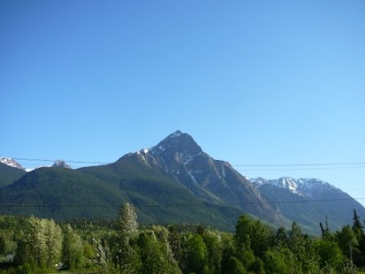
At this point I'm going to stop writing so much and let the pictures do the talking. I headed into British Columbia, and well, you be the judge.


British Columbia, you have my attention.
As I ventured north towards the Cassiar High way, which would eventually connect me to the Alaska-Canada (Al-Can) in the Yukon Territory, the settlements became farther and farther apart. by the time i reached Prince George, a half tank of gas meant that I filled up in the next town, otherwise I risked hitting "E."
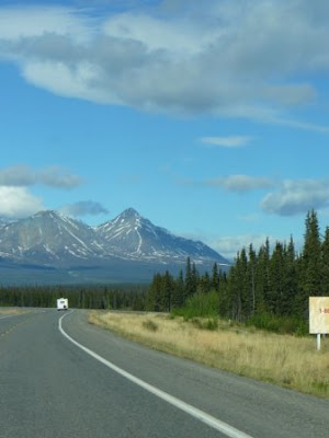
Then came the Cassiar Highway. This road cuts directly through northern British Columbia. Large stretches still remain unpaved, and most truck traffic follows the the AL-Can, so more often than not I saw one of these guys (above) before I saw a fellow traveler. There's also only one real settlement in all of the Cassiar's 450 miles at Dease Lake, the town of Cassiar itself is actually abandoned. Though beautiful and remote, I often drove with white knuckles, fearing the craters in the road would blow out my light summer tires, or worse yet my trusty ride would break down.
Yukon wins "Best State of Provincial Slogan Award" for the trip.

I enjoyed a clear view for all of five miles after each refueling (assuming I was at a gas station so luxurious that it actually had a squeegee and some windshield fluid)


The Yukon was far more beautiful than I anticipated. I had expected only muskeg and tundra, which there was plenty of, the mountains and pristine lakes came as a surprise.
After three days of driving in kilometers I hit US soil again. I also finally made it back into cell phone range after a few days without it, calming some frayed nerves back east. Day 11 was an all out 800 something mile blitz from Whitehorse to Sterling.


Top to patchy bottom skiing at Aleyeska on June 4th.
Standing on 4 feet of snow in the midnight sun (or cloud cover). It took a few days to ruefully go back to wearing pants and a jacket after wearing shorts and tee shirts for the past month.


Ok, glad that's over with, I know its a bit short considering the lenghth of the journey, but its also been a while and I'll probably end up doing at least half of it again in only 2 months.
Now, for a moose burger, I don't know how that's relevant to this post, but it is.


No comments:
Post a Comment