Trent and I chatted mid-week, and as the weather began to
shape up, the plan was made: overnight in Mills and ski one of the drainage’s big
peaks.
There were two possible targets: Peak 54XX – Beluga/El
Tercero, or Peak 52XX – Stormy, see the
end of this post for more information on naming and history in this area.
Our plan was to set up a lightweight camp, recon the north
face of Stormy, and based on what we saw, pick a peak. Ideally, we would have
stuck around for three days and tagged both, but that wasn’t an option this
weekend. On board for the adventure was Nathan, Trent, and Tony.
The crew assembled and skied in, stomping in a cozy camp.
Mills Creek Valley is kind of the bottom of a bucket, and only catches mid-day
sun, even now at equinox, so we enjoyed a leisurely lunch and soaked up the
sun’s rays, knowing it was going to be shady and cold when we returned later in
the evening.
 |
| Inbound |
 |
| Chatting after stomping in camp. |
 |
| The single-planker corner of camp, we had the boom box and the Mountain Dew. |
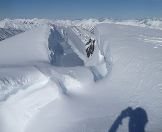
Adorned with massive overhanging cornices blocking access
along nearly the entire summit ridge, cliffs and rock are more abundant then
spines of snow on this face, and in the end, the run is cut a bit short by
the dying Stormy glacier below.
I’ve got a pile of photos of Stormy taken over the years,
and one thing was clear, it rarely sets up.
I had compared photos taken the prior weekend from Spirit
Walker with photos I’d taken of Stormy in the good snow years of 2013 and 2010,
and I knew even from the recent pictures, for once, there were some real leads.
In March of 2013, there was no conceivable way to ski off
the summit of Stormy without doing some bogus stunt. There was way more rock
showing that year too. The photo from 2010 was taken in mid-May, so some of the
cornices had broken away revealing more potential entries, but even still, it
was clear skiing onto the face was going to require a great deal of commitment.
From camp on Saturday though, the entry line was right there
for all to see, standing out clear as could be, exactly what we hoped to see: a
perfect but narrow snow ramp that dropped right off the summit ridge into the middle
face.
Nathan was wise and brought binocs, so we were all able to
get a good look at it.
The winds had backfilled a perhaps 20-foot wide section of the
corniced ridgeline. On either side of the ramp, the cornices quickly grew back
to unfathomable size.
We could see that we were going to face a very steep entry,
but once off the ramp and into the meat of the line, there were a couple
different chutes of varying size and character to choose from that all flowed
steeply down another 700 feet or so to the glacier in a manageable manner.
With everything we needed to know about Stormy’s north
perspective already answered, we decided to take a tour into Beluga’s unnamed drainage
to have a look at the king peak of the Mills Creek drainage, and stomp in our
route to the headwall that divides the connecting ridge of the two peaks.
We ended up touring right to the base of the valley’s
headwall, getting a great look at Stormy’s crazily snow-ribbon-adorned
southwest pinnacles, and Beluga’s giant north couloir.
The latter was very inspiring, and certainly tugged at the
strings of wants versus cans.
The tour from camp to the base of the headwall was 4 miles and
acquired about 2,000 feet of vert along the way.
It was too flat to justify boarding back out the valley, so
Nathan and I joined our two-plank partners and we all partied back down to camp,
seeing who could make the most Mike Wiegele FGP wiggles. It was good to see
Beluga’s crown line up close having never been there before, but in retrospect,
I’d probably forgo the full valley track stomp, and tag one of the dozens of
enticing runs along the way. It was a riot nonetheless, and Nathan and I agreed
we both hit our top speeds on split skis straight lining some of the steep
moraines. At one point, all of us were cruising along right next to each other,
not saying a word, just making little swish turns in the soft pow, and I turned
to my right and watched Tony repeatedly dropping knee and throwing flumes of
snow that caught the golden sunlight just right…it was pretty spectacular in
the moment.
As the sun set back at camp, the north face of Stormy saw its
first light of the day, the last glowing rays painting soft orange hues across
the upper ridge, capturing our dreams before we all turned in.
 |
| Check out the cool snow features on Stormy's SW pinnacles. |
 |
| Stormy's south face. Pretty cool lines. |
 |
| The ridge to Beluga. |
 |
| Beluga North Couloir. Photo: T.S. |
 |
| The last light of the day is the first light Stormy's north face sees all day. |
The next morning we were off early enough through the cold
morning light, happy to be cruising on our pre-broken trail.
We decided to split into pairs to ascend the steep headwall
to avoid putting all 4 of us out at once. I’m glad we did. In the summer, this
headwall is actually a central cliff face with two steep chutes on the either
side. Both the chutes sported cornices above and obvious wind loading within,
leaving only the mostly filled in cliff (thanks El Nino).
Luck had it that I got to lead the (kind of) crux pitch over
the cliff lip. Nathan took the first stab, but his immediate position put him
into deep sugar snow and rock. I took a stab from my position and found firm
snow right to the edge of the lip. Above the lip there was about 6 inches of
fresh over 6 inches of older rotten snow over bare rock.
It literally came down to 2 near-identical moves that
involved wedging my whippet tip into a small rock crevasse and pulling my
entire body up with no other connection point until I could get a meager toe
hold, re-stabilize, and repeat the move.
The irony of the fact that I’m not a climber was more in my
face than the sugar snow or the bare rock that promised to bruise me if I
slipped.
Above the lip, the snow was superbly boot-able and we took
advantage of it to nab a bunch of vertical in a hurry before clicking back into
the skis to finish off to the ridge.
The crux ultimately only got a “kind of” designation, by the
way, as a more patient and methodical Trent and Tony moved a little left of our
path to find firm booting through a gap in the rock face that both Nathan and I
both expected to find only bottomless sugar in.
Suffice to say, our wait on the sunny ridge was happily shorter
than expected.
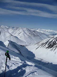
That being said, the views out east over Johnson Pass and
beyond were jaw dropping.
At this point, it was decision time.
The Beluga-Stormy combo, plus an exit with overnight packs,
was going to be asking a lot. With one peak and an exit, we were still looking
at getting back to the cars around dusk, going for both meant an assured
headlamp exit, probably getting back to the cars at 9 or later, and everything
was going to have to be rushed. If we skied the combo, Beluga was up first, but
the odds were stacked in Stormy’s favor.
Tony had skied Beluga before, never Stormy though, and to
his knowledge, neither had anyone else. It’s not say it was a for sure first
descent, but it was highly probable.
Beluga is beautiful, bigger, but far less complicated, its
aspect and elevation ensure it will ski for weeks to come. The same could not
be said for Stormy. We knew the mountain was in rare and prime condition at the
moment. The entry ramp was small, and a good spring storm could destroy it.
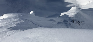
The ridge to Beluga sported at least one cruxy cornice in
plain sight, possibly more out of sight; the ridge to Stormy involved a longer
but easy trek across two big, wide, flat, wind-swept summit fields.
To Stormy we went.
The mountain’s true summit is the east peak, despite the
contrary appearance from below, and we gave the ridgeline a wide girth as we
approached it. Cornices the size of modular homes were peeling away from the summit.
Peering into the deep cracks below we could see big chunks of rock being
extracted from the mountain. Some of the gaps were so big a car could easily
have driven between the face of the mountain and the creeping cornices; it was
truly wild and scary.
Conveniently, from the summit, we could see our entry ramp
in the center of the summit ridge, though there was a bit of debate.
Nathan and I talked Trent into the ramp as it was impossible
to see what you were approaching from head on. Once Trent was posted we all
joined him, and so formed the knots.
The ramp did exactly what we knew it would, but holy crap,
it was not fun to look at, as there was nothing to see.
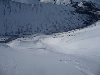
About 20 feet wide and veering left, the ramp rolled over so
steeply that all we could see of the slope below were two giant “ice cream
dollops” that adorned the tops of the big spines about 100 feet below, and after
that, the glacier, 700 or so feet below.
We were pretty sure the dollops were part of the big spines
that formed the face’s main chutes, but there was literally no way to see for
sure without getting out onto the convex ramp. Knowing how much of the mountain
did not go, the risk of getting it wrong was too high, and the mind games
began.
Hesitantly, I eased out on the ramp, thumping it progressives,
like that was somehow going to mean anything. Once I stepped down a bit though,
I could at least see two obvious places above the dollops to post up on, though
the rest of slope was still hidden.
Everyone else took a look too, and we agreed, this was it.
Nathan swallowed the lump and agreed to take the line first.
As we had seen from below, the ramp was going to be the
worst of it. Below, the chutes were steep, but also had big spines to pull up
onto.
We took our time during the transition and radioed up. Like
last week, someone else was on the channel, and as we tested, they got in on
the action; unlike last week, my patience was thin and I really didn’t care,
they could change their channel if they didn’t want interference, I had other concerns.
When Nathan was ready, he dropped the ramp, staying sharp
skiers left and running to the post up 100 feet down.
He was out of sight, but once there, he reported exactly
what we expected, we were in. There were three chutes to choose from, the cut
from the ramp was non-reactive, he would cut a chute and then ski down to the
glacier below and radio back up.
A couple minutes later he was back on the mic, reporting
fantastic snow.
Trent dropped in next, and though Nathan’s English was
assuring, Trent’s body English was more so. Trent started to ski the ramp left,
but before he went out of sight he cut back to center. I watched Trent make this
transition turn, and his body language told me everything: from his vantage I
knew he had just put eyes on the entire slope, and the way he turned blasted
confidence, it blasted form, and it blasted “this of going to be awesome.”
Nathan radioed up once Trent was down, and it was my turn.
To be straight up, I wasn’t really proud of my run. The snow
in the chutes was incredibly good, deep, light, and steep. Quite early on
though I got enough slough moving that I started to get overwhelmed by the
powder cloud I was throwing up and felt it start to steer my board beneath me.
Scared, I charged into an adjacent spine, plunging my arms into the snow as
anchors while slough poured past; it was light and inconsequential, but I realized
I had to make better use of the spines the rest of the way down, letting the
slough run, before finally opening the throttle down the apron to meet up with
the Trent and Nathan. In retrospect, I was calm off the drop, and just wanted
to charge once I got in the line; but once I was in, the options overwhelmed me
and I slowed down instead of speeding up. I wish instead of going for the hard
charge off the top, I’d run to the post up, re-evaluated my options, and then
charged: I think I would have had a better run. Serious over-analyzation here
though, it was pretty fantastic.
Once everyone was re-grouped, we partied back out down the
glacier. Along the way, we turned around to see the crescent moon rising directly
above the summit and our tracks weaving down.
Stoke was on high, the weekend was a definite success, we
all wished we could stay another day, but as expected, by the time we’d break
down camp and ski back out it would be after sunset. I think all of us can’t
wait to get back there for more though.
 |
| Sunup over the headwall. Photo T.S. |
 |
| A hidden peak with great appeal. |
 |
| Beluga |
 |
| Tony on the ridge above the headwall with mountains after mountains beyond. |
 |
| There is just so much out there needing to be skied...it's kind of overwhelming. |
 |
| Trail Lakes and the Resurrection Bay in the distance. |
 |
| Pictures fail. |
 |
| The view above the ramp. See what I mean about not being able to see the line? |
 |
| Yours truly. Photo: T.S. |
 |
| Photo T.S. |
 |
| Trent got line of the day. Photo N.W. |
 |
| Awesome weekend. Photo T.S. |
History and Naming
Tony, who has skied off Peak 54XX (Beluga/el Tercero), has
referred to it as Beluga Peak. The steep, glaciated, bulging summit field that
hangs suspended over the mountain’s big cliff face does indeed resemble a
breaching beluga, and the name fits well.
A search through the Mountaineering Club’s Scree archives
showed that fellow Vermonter and all-around badass Tim Kelly and a small crew
had traversed the entire ridge east of Johnson Pass Trail starting in Moose
Pass and ending at Silvertip Creek in a two-day run back in the summer of 2000.
Along the way, they found cairns on Beluga’s summit, as well as cairns on the
prominent summits south of Beluga. They also found a register on the summit of
Peak 5010 (Caboose) just south of Beluga, that was signed by the Bludworth
brothers, and dated to late July of 1969, a week or two after the two brothers
had notched the first recorded climb on Bench Peak. The brothers were getting
after it hard in the greater Johnson and Bench creek drainages that month.
According to the note in the register, the brothers had
traversed from Moose Pass at least as far north as Beluga, which they called El
Tercero. They named the three peaks to the south of Beluga/El Tercero: Caboose,
Tender, and Engine/Locomotive, respectively, for the resemblance of the latter
two peaks to a train and tender. The four peaks together were referred to as
The Four Brothers.
When Tim and his crew continued on north of Beluga/El
Tercero in 2000, they didn’t find a cairn on Peak 52XX (Stormy), nor any of the
other high points along their route for that matter.
Peak 52XX is otherwise unnamed, but stands above Stormy
Creek, and, amongst a small group of skiers, has taken the traditional name of
otherwise unnamed peaks and ski aspects: Stormy Peak, after its drainage.
There’s a lot of history in the Mills Creek area going back
to the turn of the last century and the mining boom that briefly bloated the
population of the northern Kenai in the late 1890s, but so far, I have yet to
dig up any specific references or tales from Stormy Creek or its history. It’s
something of a chuckle to me though that timberline in Mills Creek is found not
at Timberline Creek, but at Stormy Creek. It is quite likely that at the turn
of the century, what are essentially just rock glaciers now in the eastern
drainages of Mills, might have actually consisted of small but solid ice
sheets. Perhaps timberline was lower then, and that would certainly have made a
place like Stormy Creek fairly unattractive to miners, who were finding
plentiful color farther downstream anyway. As it was, access to Summit Lake from
the Hope/Sunrise area was quite the fiasco as late as the 1930s.
To an extent, for the middle Mills, it still is: Tim said
there were no other entries in the register on Caboose when they passed by in
2000.


